 Aqeela_Image / stock.adobe.com
Country Guide № 106 / 194 · Oceania
Marshall Islands
Twenty-nine atolls, Bikini's ghost fleet, and a country two metres above the sea.
“Twenty-nine atolls, Bikini's ghost fleet, and a country two metres above the sea.”
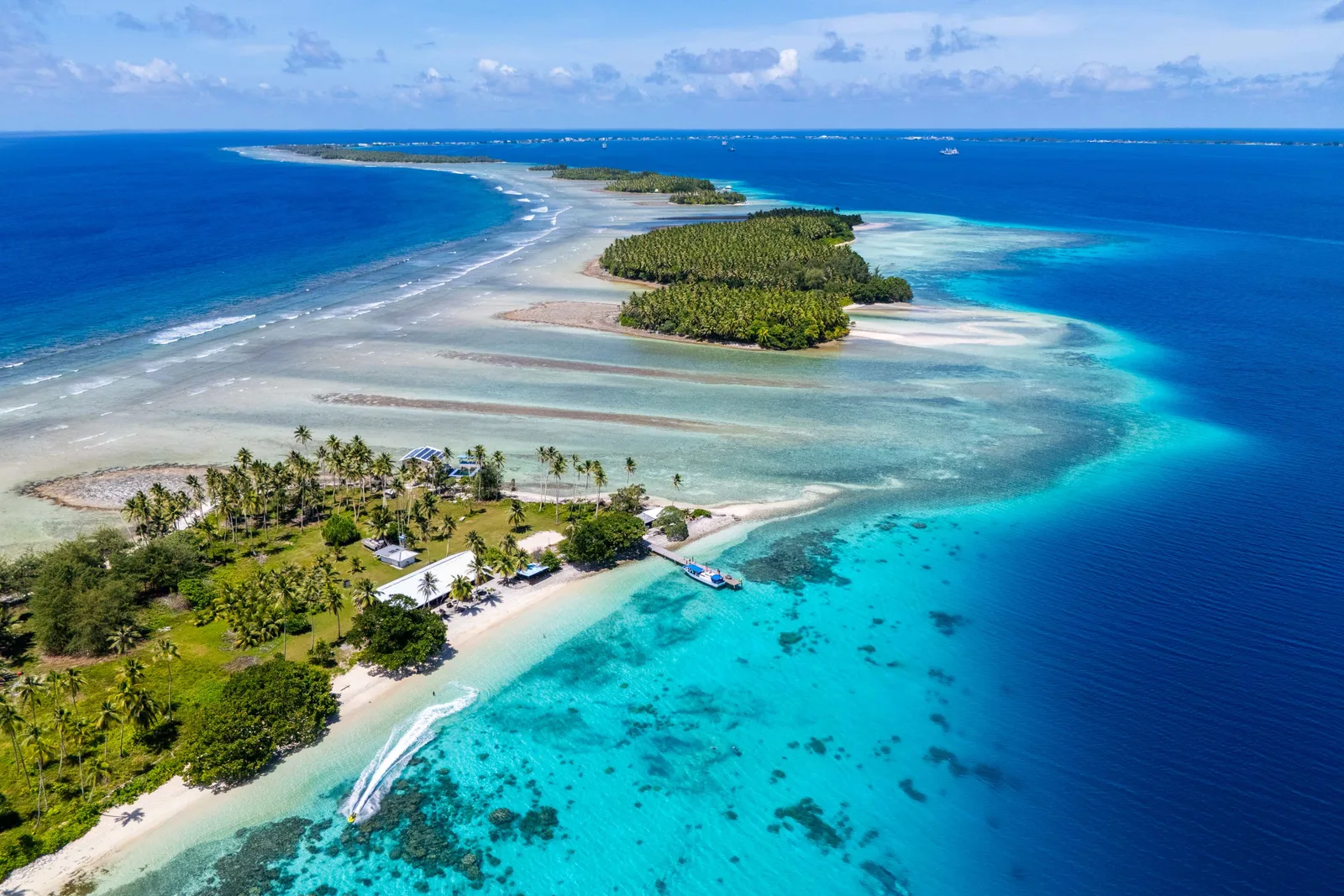
The Marshall Islands are 29 coral atolls and five islands scattered across nearly two million square kilometres, with a total land area of about 180 square kilometres and an average elevation around two metres. That elevation is the country's central political fact: it is among the most exposed nations on earth to sea level rise, and Marshallese diplomats have been the loudest voices in climate negotiations for three decades.
Between 1946 and 1958 the United States detonated 67 nuclear weapons at Bikini and Enewetak, including Castle Bravo, the largest US test ever. Bikini's population was moved and has never fully returned; the lagoon holds the target fleet, including the aircraft carrier USS Saratoga and the Japanese battleship Nagato, in one of the most extraordinary and difficult wreck-diving sites in existence. Access depends on charter availability and has been intermittent for years.
Chapter 01
Highlights
Bikini Atoll
A UNESCO World Heritage site and the target of 23 nuclear tests. The lagoon holds the USS Saratoga, the battleship Nagato and other target ships in divable condition. Access is by charter and has been intermittent - verify before planning anything around it.
Majuro atoll
A ribbon of land around a huge lagoon, in places narrow enough to see both ocean and lagoon from the road. The Alele Museum, the handicraft co-operative and Laura beach at the western end.
Arno and Mili
Atolls near Majuro reached by boat or small plane, with wartime relics, empty beaches and outer-island life almost untouched by the capital.
The Marshallese stick charts
Navigation charts of palm ribs and shells that mapped swell patterns rather than land - a wayfinding system unique to these islands, and best seen at the Alele Museum.
Chapter 02
Entry requirements for Marshall Islands
Checking your passport…
free entry
Before you fly
The detail
- Fee
- free entry
- Passport validity
- Most destinations want validity beyond your stay, and some want six months. Check yours against the return date.
- Onward travel
- Airlines may ask for a return or onward ticket at check-in.
- Health
- No malaria. Dengue outbreaks occur. Medical facilities are limited to Majuro and Ebeye; anything serious means evacuation to Honolulu. Water supply on atolls is rainwater-dependent and can be scarce in drought.
- Money
- US dollar. Cash dominates. ATMs in Majuro and Ebeye; nothing on the outer atolls. Bring dollars for the whole trip.
The Marshall Islands is not an ordinary destination for a United States passport, and the entry line understates what you are actually holding. Under the Compact of Free Association a US citizen may enter the Marshall Islands, live there and work there without a visa, a permit or a sponsor. That is a right of residence rather than a visitor's allowance, which is why no number of days is stored against this row: there is nothing to count down. What the treaty does not do is stand in for the passport, so carry a valid one, and it does not move the airline's own requirements either. Carry the onward ticket and the first accommodation booking in a form you can show on a phone. Across the Pacific these are asked for far more consistently than in most of the world, and they are asked for by the AIRLINE at check-in rather than by the Marshall Islands at the door - a carrier that lands somebody in a country they have no way out of owns the cost of taking them home, so the refusal comes from a check-in agent hours before anyone official has looked at your passport. Two things a Compact right will not open. Kwajalein is a United States Army installation, and access to it - including the flight into Bucholz that is how almost everybody reaches Ebeye next door - is controlled by the garrison and needs authorisation arranged in advance through a sponsor; American citizenship is not that authorisation and turning up without it means not boarding. Bikini is the other: visiting the atoll requires the permission of the Bikini local government, and the dive charter that made it practical has run only intermittently, so treat it as an expedition to be arranged months ahead rather than an excursion to be booked on Majuro. The ordinary business of a visit - a room, a boat, cash - runs on US dollars and largely on cash, because card acceptance outside the hotels in Majuro is thin and there is none at all on the outer atolls.
Check another destination with this passport →
Entry details: Editorial synthesis - Compact of Free Association entry and residence provisions, RMI Immigration practice, USAG-KA access rules (2025–2026) · compiled 18 Sept 2026
Who needs a visa for Marshall Islands
12 common passports| Passport | Requirement | Stay | Process |
|---|---|---|---|
| United States | Visa-free | - | No process · €0 / $0 |
| United Kingdom | Visa-free | up to 90 days | No process · €0 / $0 |
| Germany | Visa-free | up to 90 days | No process · €0 / $0 |
| India | Visa on arrival | - | No Other passports record yet |
| China | Visa required | - | No Other passports record yet |
| Brazil | Visa on arrival | - | No Other passports record yet |
| Nigeria | Visa required | - | No Other passports record yet |
| Indonesia | Visa on arrival | - | No Other passports record yet |
| Philippines | Visa on arrival | - | No Other passports record yet |
| Vietnam | Visa on arrival | - | No Other passports record yet |
| Egypt | Visa on arrival | - | No Other passports record yet |
| Nepal | Visa required | - | No Other passports record yet |
Holding a passport that is not listed? The picker above answers for any of them. See where your passport takes you. Source: Passport Index, updated 14 Aug 2026.
Chapter 03
When to go
BestDec–Apr.
Dry season; calm lagoon and good visibility.
The band above each month is our editorial verdict - it weighs crowds, prices and access as well as weather. The line is average daily temperature, the bars are monthly rainfall. Select a month for the figures. Climate figures: ERA5 reanalysis via Open-Meteo, 2005–2024 normals.
Chapter 04
What it costs
A day in Marshall Islands
Comfortable · sample day
≈ $173
Line items are real prices we track. The daily budget is an editorial estimate for this level, not their sum.
Where this sits among 244 countries we have costed
There is effectively no tourist season. Majuro hotel demand comes from government, fisheries and aid traffic, and prices are flat.
Updated Aug 2026 · Editorial synthesis - operator quotes and market sampling (2025–2026) · confidence low
Excludes international flights - they depend on where you fly from.
Chapter 05
Regions to know
5Majuro
The capital atoll - the lagoon road, the Alele Museum, Laura beach and the handicraft co-operative.
Kwajalein and Ebeye
The world's largest lagoon by area, a US missile test range, and Ebeye's densely populated island alongside it.
Bikini and Enewetak
The nuclear test atolls - Bikini's ghost fleet on the lagoon floor and the Runit Dome on Enewetak.
The Ratak chain
The eastern "sunrise" chain - Arno, Mili, Maloelap and Wotje, with wartime relics and outer-island life.
The Ralik chain
The western "sunset" chain - Ailinglaplap, Jaluit's German-era trading history and Namu.
Chapter 06
Practical guide
Getting there
Majuro is served by United's island-hopper from Honolulu and Guam, and by Nauru Airlines from Brisbane and Nadi. Kwajalein is a US military installation and is not a civilian entry point.
Getting around
Air Marshall Islands flies domestically with variable reliability. Field-trip ships serve the outer atolls irregularly. On Majuro, shared taxis run the length of the atoll for a fixed low fare.
Money & costs
US dollar. Cash dominates. ATMs in Majuro and Ebeye; nothing on the outer atolls. Bring dollars for the whole trip.
Safety
Generally safe with petty theft in Majuro. The real constraints are logistical and environmental - king tides flood parts of Majuro, drought affects water supply on the atolls, and evacuation from anywhere outside the capital is slow.
Health
No malaria. Dengue outbreaks occur. Medical facilities are limited to Majuro and Ebeye; anything serious means evacuation to Honolulu. Water supply on atolls is rainwater-dependent and can be scarce in drought.
SIM & internet
National Telecommunications Authority; SIMs in Majuro. Coverage in Majuro and Ebeye; a submarine cable has improved bandwidth substantially. The outer atolls rely on satellite or have nothing.
Chapter 07
Driving
Majuro has a single road running about 50 kilometres along the atoll rim, with a 25 mph limit and shared taxis stopping constantly. There is nowhere else in the country with a road network worth the name.
Rules change - verify with an official source before you rent.
ExplWorld VerifiedNo verified partners here yet - all 6 country seats are open.
Become ExplWorld Verified →Chapter 08
Itineraries through this country
Chapter 09
From the Journal
Chapter 10
Before you go
Marshall IslandsChapter 11
Frequently asked questions
Is Bikini safe to visit and can I actually get there?
Diving and short visits are considered safe - external radiation levels in the lagoon area are low - but eating locally grown food there is not, because caesium persists in the soil and enters the food chain. Access is the harder question: it depends on a functioning dive charter and has been suspended for long stretches. Confirm with operators before building a trip around it.
How do I get to the outer atolls?
Air Marshall Islands flies a limited domestic network with a reputation for cancellations, and government field-trip ships visit the outer atolls every few weeks with no fixed schedule. Reaching an outer atoll means accepting that your return date is approximate.
What should I understand about the nuclear legacy?
Sixty-seven tests between 1946 and 1958 displaced communities from Bikini and Enewetak, exposed people on Rongelap to fallout, and left the Runit Dome - a concrete cap over contaminated debris on Enewetak that is itself now a concern. It is not history here; compensation, resettlement and health effects remain live issues. Be careful and respectful in how you raise it.