Itinerary · Asia · 14 days · Moderate
Everything on One Road
Yerevan→Tsitsernakaberd→Zvartnots→Geghard Monastery→Amberd→Gyumri+8 stops
Turkey and Azerbaijan keep their frontiers with Armenia shut, so roughly four fifths of the land border is closed and the entire country moves on a single north–south axis between Georgia and Iran. Fourteen days on it: monasteries cut into gorge walls, a second city still smaller than it was in 1988, a lake being refilled through two tunnels, and the world's longest reversible cable car at the end.
Yerevan, the plan
Alexander Tamanyan drew the modern city in 1924 as a ring boulevard around a neoclassical core, and had it built in the volcanic tuf quarried up at Artik, which is why the whole centre is pink and apricot and matches itself. Republic Square went up in stages over thirty years. Walk the Cascade at the end of the day: begun in 1971, abandoned when the money and then the country ran out, and finished from 2002 with a diaspora collector's fortune. Ararat sits on the horizon about 60 km (37 mi) away and is in Turkey.
Yerevan, the archive and the memorial
The Matenadaran holds the national manuscript collection, around seventeen thousand codices, in a building opened in 1959 that looks like a bunker because in part it is one. Then Tsitsernakaberd. Something like a hundred thousand people demonstrated in this city on 24 April 1965 demanding the genocide be marked; the memorial opened two years later and the museum in 1995. Afterwards the GUM market for dried fruit and sujukh - the walnut-and-grape-must rope, not the sausage - which is the correct way to end that afternoon.
Vagharshapat and Zvartnots
Twenty kilometres west to the seat of the Armenian Apostolic Church, founded by tradition in the first years of the fourth century and still the residence of the Catholicos. St Hripsime of 618 is the better building - a compact domed cross that half the churches in this itinerary are descended from. On the way back, Zvartnots: a vast circular cathedral raised in the 640s, collapsed some three centuries later, dug up from 1900 and left as a ring of column drums in a field.
Garni and Geghard
Garni is a first-century Ionic temple on a spur above the Azat gorge, brought down by the earthquake of 1679 and reassembled between 1969 and 1975 from its own fallen blocks; the dark stones are original and the pale ones are not, and you can read the ratio off the walls. Below it the gorge sides are hexagonal basalt columns. Geghard, twenty minutes on, is the opposite idea - chambers hollowed backwards into the rock in the thirteenth century, with a spring running through one of them.
Aragats, then north-west
Up the Kasagh gorge to Hovhannavank and Saghmosavank, put up by the same princely family in the 1210s on the very lip of a 100 m (330 ft) drop. Then Byurakan, where Viktor Ambartsumian founded the observatory in 1946 and the 2.6-metre telescope is still working, and Amberd, a fortress on the south flank of Aragats at about 2,300 m (7,550 ft). If the Kari Lich road is open, go on up to 3,200 m (10,500 ft) for the lake below the summit. Sleep in Gyumri.
Gyumri
At 11.41 on 7 December 1988 a magnitude 6.8 earthquake destroyed the town of Spitak and much of what was then Leninakan, killing around 25,000 people. Soviet reconstruction began and stopped when the Soviet Union did, and families lived in domiks - metal container shelters meant for a winter or two - for the better part of thirty years. The city has roughly half the population it had that morning. The Kumayri district survived, as it had survived the quake of 1926: over a thousand houses in black and orange tuf, eighteenth to early twentieth century, standing where the concrete around them did not.
East to the Debed
Across the top of the country through Vanadzor and down into the copper canyon. Alaverdi has been smelting since the eighteenth century, ran under a French concession before 1917, and still lifts people from the valley floor to the plateau above on a Soviet cable car. Stop at Odzun on the way in: a sixth-century basilica standing on open ground with the gorge behind it.
Haghpat, Sanahin, Akhtala
Two monasteries on facing shoulders of one gorge, founded ten years apart - Sanahin in 966, Haghpat in 976 - by the same queen, Khosrovanuysh, wife of Ashot III, and jointly UNESCO-listed since 1996. The name Sanahin is glossed locally as this one is older than that one, which tells you what the relationship has always been. The Mikoyan brothers were born in the village below it - Anastas held office from Lenin's time to Brezhnev's, retired in 1965 and died in his bed, which at that level almost nobody managed; Artem designed the MiG, and there is a fighter on a plinth outside the house. North at Akhtala, a fortress church keeps thirteenth-century frescoes that are more complete than anything else in the country.
Into Dilijan
South-east over the Pambak range into forest - beech and oak, cloud, and a climate that has nothing to do with the rest of Armenia. Haghartsin sits in a clearing above the town and was rebuilt between 2010 and 2013 with money from the ruler of Sharjah, which is why it looks newer than its tenth-century foundation. Goshavank, further east, is named for Mkhitar Gosh, who wrote the first Armenian law code here in the 1180s.
A day on the Transcaucasian Trail
The first properly built sections of the trail were cut through this national park from 2015 by volunteer crews, and the Dilijan stretch is the one to walk: waymarked, graded, and reachable from town without a car. The usual day is out to Parz Lich and on to Gosh, five or six hours through forest, with a marshrutka or a taxi back.
Lake Sevan
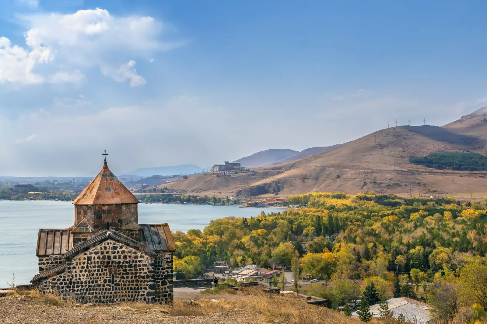
Sevanavank was founded on an island in 874 and stands on a peninsula now, because Soviet drawdown took about nineteen metres off the water and joined it to the shore. Down the west coast to Noratus, where roughly nine hundred khachkars - carved cross-stones, no two alike - stand in a working village cemetery. It is the largest field of them left anywhere since the far bigger one at Julfa was destroyed.
The Selim pass and Vayots Dzor
Round the south of the lake and over the Vardenyats pass at 2,410 m (7,910 ft), where the Orbelian caravanserai of 1332 sits just below the summit - three barrel-vaulted aisles, no windows, still standing and still cold. Down into red rock at Areni, where excavation of a cave between 2007 and 2010 produced a leather shoe about 5,500 years old and a winery about 6,100. Noravank at the end of a side canyon, with Momik's 1339 church and its cantilevered stone stairs bolted to the front.
Yeghegis, Sisian, Goris
Up the Yeghegis valley first, where a Jewish cemetery was excavated in 2000 and 2001 with stones inscribed in Hebrew and Aramaic and dated between 1266 and 1346 - a community nobody had documented. Then over the Vorotan pass to Zorats Karer near Sisian, a Bronze Age site of 223 standing stones, about eighty of them bored through, whose astronomical readings are argued about and whose age is not. Old Khndzoresk in the afternoon: a cave village lived in until the 1950s, reached by a swing bridge across the valley.
Tatev, and back
The Wings of Tatev opened in October 2010 and runs 5,752 m (3.6 mi) - the Guinness record for a non-stop reversible cable car - crossing the Vorotan gorge in about twelve minutes, some 320 m (1,050 ft) above the river at the deepest point. At the far end is a monastery founded in the 890s that ran one of the medieval world's more serious universities in the fourteenth and fifteenth centuries. Then the M2 north. Stop at Khor Virap, where Gregory the Illuminator was held in a pit for thirteen years before converting the king who put him there, and where the border fence and Ararat are in the same frame.
Good to know
Entry is the simple part: EU, UK, US, Canadian, Australian and Japanese passports need no visa and get 180 days in any one-year period, and Zvartnots issues visas on arrival for most nationalities that do need one. Borders are the complicated part. Only two of Armenia's four land borders are open. Turkey closed its frontier in 1993 and Azerbaijan's has never functioned, so everything arrives by air at Zvartnots, through Georgia at Bagratashen, Bavra or Gogavan, or through Iran at Agarak - Tbilisi to Yerevan by marshrutka is around six hours plus the crossing. Nagorno-Karabakh is not open to visitors: the Armenian population left in September 2023, the territory is under Azerbaijani control, and mapping apps still draw roads into it that you cannot use. Onward travel is affected too: Azerbaijan refuses entry to anyone it can establish has visited Nagorno-Karabakh, there is no crossing between the two countries in either direction, and a trip covering both means flying out through a third country. The other border problem is closer to this route - since 2021 several stretches of the old Goris–Kapan highway pass through Azerbaijani-controlled ground with checkpoints on them, and Armenia opened an alternative through Tatev and Aghvani. If you continue south to Kapan or Meghri, take that road and confirm the current position first. The Wings of Tatev is closed all day Monday for technical maintenance, shuts in high wind, and takes a longer service window once a year; the fallback is the switchback road down through the gorge past the Devil's Bridge, about an hour each way. The Vardenyats (Selim) pass is closed by snow for much of the winter and the diversion is the M2 through Yeghegnadzor, which adds time but always works; the Kari Lich road on Aragats is usually blocked until late June. Marshrutkas leave when full rather than on a timetable, from Kilikia station for the south and the northern station for Gyumri and Vanadzor. A car with a driver for the Aragats, Vayots Dzor and Syunik days costs little split three ways and saves several hours each time; GG and Yandex Go work in Yerevan. Cards are fine in the capital and unreliable outside it, so carry dram. May–June and September–October are the seasons: Yerevan averages a daily high near 34 °C (93 °F) through July and August and clears 40 °C (104 °F) in a heatwave, and the high passes are the first thing to close in autumn.
Shorter or longer?
Add three days from Goris for Kapan, the Shikahogh forest reserve and Meghri, over the pass and down to the Arax. Use the Tatev–Aghvani road rather than the old highway, and understand that this is the emptiest and most sensitive corner of the country.
Yerevan and its two day trips, then Sevan, Dilijan, Vayots Dzor and Tatev. Keeps the monasteries and the cable car, cuts Aragats, Gyumri and the whole Debed canyon - which is to say it cuts the north.
Practical guide
Visa check for this route
Budget
Mid-range · per person · sharing a double room. Excludes international flights - they depend on where you fly from.
Editorial estimates · checked August 2026
Country guides
Trip essentials
The connectivity placement is our own eSIM store. No affiliate link on this list. How we choose these →