Itinerary · Europe · 12 days · Moderate
Boka to the Tara
Herceg Novi→Perast→Kotor→Njegoš Mausoleum, Lovćen→Cetinje→Sveti Stefan+6 stops
Montenegro is slightly smaller than Northern Ireland and holds a drowned river canyon that everyone calls a fjord, an Albanian-speaking salt marsh, a lake shared with Albania, a railway with 254 tunnels in it and a gorge 1,300 metres deep. This is the whole country on buses, boats and that railway, with a hire car for the four days the timetable gives up.
Herceg Novi
The town at the mouth of the bay, built in steps up a slope, with a fort from every occupier: Bosnian from its founding in 1382, Ottoman for two centuries, Spanish for nine months across 1538 and 1539 until Barbarossa took it back by siege, then Venetian, French and Austrian. Kanli Kula was the Ottoman prison and is now an open-air theatre. Start here rather than in Kotor and the bay unfolds in the right order.
Perast and Risan
Perast counted 269 residents at the last census and has sixteen palaces, because its captains worked for Venice and were paid accordingly. Our Lady of the Rocks, offshore, is an artificial island - boats have been dropping stones on a reef here for five centuries, and still do every 22 July at the Fašinada. Risan, ten minutes back along the same shore, has the mosaic floors of a second-century Roman villa, including a sleeping Hypnos, on ground that was the capital of Queen Teuta's Illyrian kingdom.
Kotor
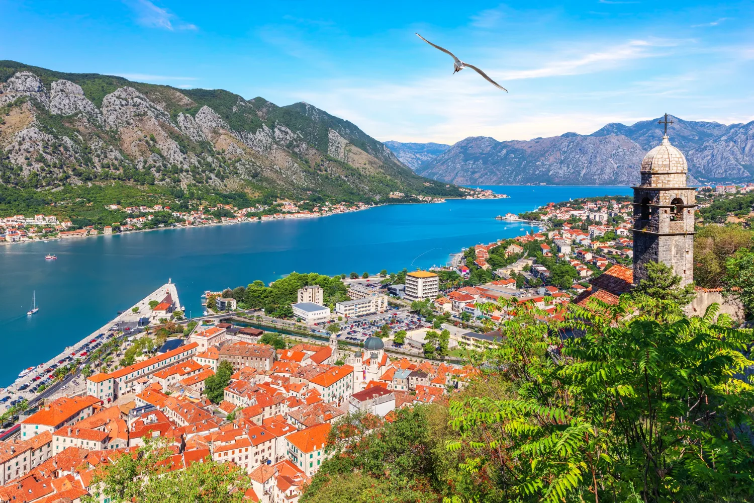
Four and a half kilometres of wall climb the cliff behind the town to the fortress of St John at 260 metres. Do it before nine. The earthquake of 15 April 1979 nearly finished the place; UNESCO listed the bay that October and simultaneously entered it on the List of World Heritage in Danger, where it stayed until 2003. Almost everything you walk past was put back together in the twenty years in between.
Over Lovćen to Cetinje
Hire a car for this. The old road leaves Kotor and climbs the wall of the bay in a stack of hairpins to Njeguši, where the Petrović dynasty came from and where the ham is cured. Above it, on Jezerski vrh at 1,657 metres, is Ivan Meštrović's mausoleum for Petar II Petrović-Njegoš - prince-bishop, ruler until 1851, and author of the poem this country argues about most. It is 461 steps up through a tunnel. Down the far side to Cetinje.
Cetinje
The old royal capital, and for the forty years between the Congress of Berlin recognising Montenegrin independence in 1878 and the state disappearing into Yugoslavia in 1918 it was a European capital with twelve foreign missions in it. The street of former legations - Russian, French, British, Italian - is a row of ordinary houses that were once the whole diplomatic weight of the Balkans. The monastery, rebuilt in 1701, holds the relics that made this a pilgrimage town.
Budva and Sveti Stefan
Down to the coast and into the argument about what has been built on it. Budva's old town was flattened in 1979 and rebuilt as an accurate copy over the following decade; everything around it went up afterwards, fast and mostly without restraint. Sveti Stefan is the islet-village that the state emptied of its fishermen in the late 1950s and ran as a single hotel; it was leased to a luxury operator in 2007 and has been closed since 2021 while operator and state argue about the lease and beach access. Look at it from the road.
Bar
Two towns with one name. Stari Bar sits four kilometres inland under the mountain and was abandoned after a gunpowder magazine went up in 1878 - Ottoman streets, an aqueduct, roofless houses. At Mirovica below it stands an olive tree claimed to be more than two thousand years old. New Bar on the water is Montenegro's port, the terminus of the railway from Belgrade, and the place seasonal ferries leave for Bari.
Ulcinj and the salina
The southern corner, majority Albanian-speaking, and a corsair port for most of the sixteenth and seventeenth centuries. Behind Velika Plaža, twelve kilometres of sand, lie the salt pans: 14.5 square kilometres of shallow evaporation basins worked from 1935 until production stopped in 2013, left to dry out, then designated a Ramsar wetland in 2019 after a long campaign by birdwatchers. Around 250 species use it on the Adriatic flyway. Hire a car for the day and go early.
Virpazar and Lake Skadar
North to the largest lake in southern Europe, two thirds Montenegrin and one third Albanian, a national park since 1983 and a Ramsar site since 1996. Take a small boat out of Virpazar rather than a big one: the water lilies, the flooded willows and one of the few remaining European breeding colonies of Dalmatian pelican are all in shallows the large boats cannot enter. Godinje up the hill grows Vranac and Kratošija and will pour both.
Podgorica
A capital that is honest about not being pretty. Allied aircraft bombed it more than seventy times across 1943 and 1944 - the heaviest raids in May and November 1944, and around nine tenths of the town came down - it was rebuilt as Titograd and carried that name from 1946 to 1992, and what survives of the older town is the Ottoman quarter of Stara Varoš with its eighteenth-century clock tower and the ruins above the Ribnica. Give it an afternoon and do not skip it - it is where most of the country actually lives and works.
North on the railway
The line to Belgrade took twenty-five years to build and opened on 28 May 1976: 476 kilometres, 254 tunnels, 435 bridges, and a climb from sea level to over a thousand metres. Twenty minutes out of Podgorica it crosses the Mala Rijeka viaduct, 198 metres above the stream. The line also carries a crime: on 27 February 1993 the Belgrade–Bar train was stopped at Štrpci, on the Bosnian stretch, and twenty passengers - most of them Bosniaks travelling into Montenegro - were taken off by a Serb paramilitary unit and murdered. Montenegro later paid compensation to the families and apologised for failing to protect them; a Serbian court convicted five men in 2019. Get off at Kolašin, then take a taxi the seventeen kilometres up to Lake Biograd - there is no useful bus to the gate - and walk in Biogradska Gora, which Prince Nikola closed to axes in 1878 and which is still standing because of it.
Durmitor and the Tara
Pick the car up and drive north through Mojkovac. The only road to Žabljak crosses the Đurđevića Tara bridge, so you meet it on the way in: 365 metres long, finished in 1940, 172 above a canyon 1,300 metres deep. Its own engineer, Lazar Jauković, blew the central arch in 1942 on Partisan orders, and the Italians shot him on what was left of it on 2 August that same year. Rafting parties put in downstream. Then west to Žabljak, at 1,456 metres the highest town in the Balkans, for the Black Lake and as much of Durmitor as the weather allows - forty-eight peaks over 2,000 metres, eighteen glacial lakes, Bobotov Kuk at 2,523. It was in Žabljak, on 20 September 1991, that the assembly declared Montenegro an ecological state, which is either the first such declaration by any parliament or an early piece of national branding, depending on who you ask.
Good to know
The euro is the currency although Montenegro is in neither the EU nor the euro area, so foreign cards work but ATM operator fees are normal and bus stations, park gates and village konobas want cash. It is outside Schengen too: EU, British, American, Canadian and Australian passports get ninety days visa-free, and none of those days count against a Schengen allowance, which makes this a practical place to sit out the 90/180 clock. Everyone has to be registered with the police within twenty-four hours of arrival - hotels and licensed apartments do it and hand back a white slip, but if you stay privately it is your job, at the local station. The Kamenari–Lepetane ferry across the narrows runs around the clock, crosses in well under ten minutes and costs a few euros for a car; it matters if you are coming from Tivat airport or Budva, and it does not help you reach Perast or Kotor from Herceg Novi, which sit on the same shore round the inner bay. The old road from Kotor up to Njeguši is single-lane with passing places for much of the climb: drive it uphill in the morning, before the coaches start down, and if you need to get back to the coast afterwards use the wider Cetinje–Budva road rather than re-descending the hairpins. Cruise ships put two or three thousand people into Kotor at a time between roughly ten and four, so walk the walls early or in the evening. The route takes three short hires rather than one long one - a day out of Kotor for Lovćen, a day out of Ulcinj or Bar for the salt pans and Ada Bojana, two days for Durmitor - because everything in between runs on buses and trains. Kolašin has only a handful of agencies and they want booking well ahead; a Podgorica firm delivering to the station and taking the car back at the airport usually beats a one-way charge, and it is worth settling before you arrive, since ending in Žabljak leaves the car a long way from where it started. Buses are run by competing private operators, mostly sold at station counters with only patchy online booking, and there is a small separate charge for hold luggage; coastal services are frequent and everything inland thins out sharply. Trains are cheap, slow and generally punctual - Željeznički prevoz Crne Gore publishes the Bar–Bijelo Polje timetable, and the Podgorica–Kolašin leg is bought on the day at the window. Durmitor, Biogradska Gora and Lake Skadar each charge a small daily entry fee at the gate. The Sedlo road across Durmitor holds snow into June and closes again in autumn, so check before planning a crossing rather than after. Rafting on the Tara runs from about May to early October, with the highest and coldest water in May and June, and the standard half-day is the eighteen kilometres from Brštanovica to Šćepan Polje. Sveti Stefan has been closed to visitors since 2021 and there is no way onto the causeway.
Shorter or longer?
Add four or five days from Kolašin through Andrijevica to Plav and Gusinje, under the limestone wall of the Prokletije, where Zla Kolata at 2,534 metres is the highest point in the country. The Peaks of the Balkans trail crosses from there into Albania and Kosovo, and the border permits it needs are applied for through the police a fortnight or more in advance - not on arrival.
Herceg Novi, Perast, Kotor, Lovćen and Cetinje, then down to Budva and out. Keeps the Venetian bay and the old royal capital, and drops the lake, the salt pans, the railway and every mountain.
Practical guide
Visa check for this route
Budget
Mid-range · per person · sharing a double room. Excludes international flights - they depend on where you fly from.
Editorial estimates · checked August 2026
Country guides
Trip essentials
The connectivity placement is our own eSIM store. No affiliate link on this list. How we choose these →