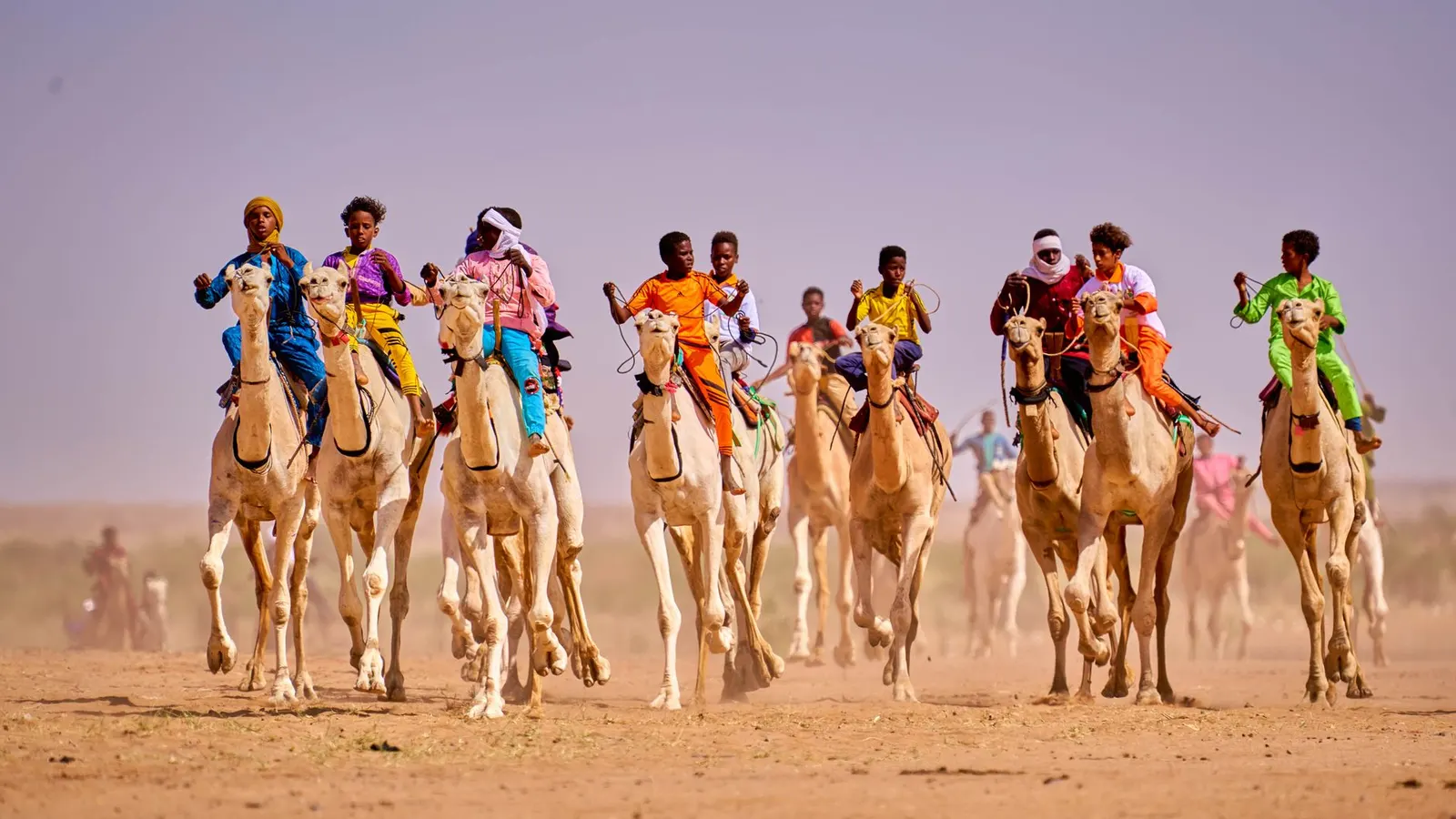
 Sani Maikatanga · Pexels License
Itinerary · Africa · 14 days · Expedition
The Aïr and the Edge of the Ténéré
Niamey→Niamey riverfront→Agadez→Agadez old town→In-Gall→Dabous+8 stops
Advisory - travel not recommended · checked 26 Sept 2026
Niger
Foreign ministries advise against ALL travel to Niger. Armed groups operate in Tillabéri, Diffa and across the Malian and Nigerian borders, kidnapping of foreigners has occurred within an hour of the capital, and the 2023 coup left regional arrangements and consular capacity unsettled. Standard scores are suspended while this alert is active.
Official advisory →Every advisory in force →Read the advisory first: foreign ministries advise against all travel to Niger, and the safest reading of that advice is that no part of the country is currently visitable - foreigners have been taken within an hour of the capital, and the regions named in the warnings run along most of the borders. This route is published for the day that changes, not as an invitation for today. It rebuilds the circuit Tuareg and Nigerien operators ran out of Agadez until around 2010, anchored only on places that were genuinely visited then: the mud-brick sultanate town, the Neolithic giraffes at Dabous, the walled oasis gardens of the Aïr, the highest ground in the country, and the western edge of the Ténéré. It goes nowhere near Tillabéri, Diffa or the Malian and Nigerian border zones.
Niamey
Arrive, and stay in the city. The Musée National Boubou Hama is the one fixed appointment: it holds the trunk of the Arbre du Ténéré, hauled here after a lorry knocked the tree down in 1973, and the dinosaurs dug out of the Gadoufaoua beds in the Ténéré - Ouranosaurus nigeriensis and the jaws of Sarcosuchus imperator, a crocodile that grew to something like eleven metres. Both exhibits are the far end of this route, seen first, in a courtyard in the capital. Everything else today is paperwork: confirm the domestic flight, confirm that your operator holds the regional authorisations, and put the permits somewhere you can reach at a checkpoint without unpacking.
The river, and nothing outside the city
The Niger runs through the capital wide and slow, and a pirogue in the last hour of light is the best hour the city gives you. The Grand Marché rebuilt itself after the 1982 fire and is where the Aïr's dates and the Kaouar's salt end up; the artisans' village at Wadata sells the silverwork you will see made in Agadez. What this day deliberately does not include is Kouré, 60 km out on the Dosso road, where the last herd of West African giraffe lives and where every visitor used to go. In August 2020 six French aid workers and their two Nigerien colleagues were murdered there. That is why the route stays inside Niamey, and it is worth knowing before you read anyone else's itinerary.
North to Agadez
Fly. The road north is roughly 950 km through Birnin Konni, which sits on the Nigerian border, and it is the single stretch of this itinerary that the advisories most obviously describe; the flight into Mano Dayak International - named for the Tuareg leader who negotiated the end of the first rebellion and died in a plane crash in December 1995 - costs a morning instead. Agadez is low, brown and built of banco, and the Grand Mosque is visible from most of it: a square tapering minaret of about 27 metres, the tallest mud-brick minaret anywhere, spiked with projecting palm beams that are scaffolding rather than decoration. The historic centre was inscribed by UNESCO in 2013. Walk the old quarter in the late afternoon when the walls go orange and the heat comes back out of them.
Agadez: the sultanate and the silver
The sultanate of Aïr moved its seat here in the fifteenth century and the palace still stands opposite the mosque with a sultan in it - an institution the colonial administration, the independent republic and two rebellions all failed to remove, which tells you what it is for. The silversmiths make the croix d'Agadez, the pierced cross that is Tuareg rather than Christian and that used to be handed from father to son at the age a boy could ride. Ask before photographing anyone. The camel market on the edge of town works early, and the yards on the north side are where the trucks used to load for Libya - the subject of the article that goes with this route.
West to In-Gall and the salt pans
Out on the tarred Tahoua road to In-Gall, a walled oasis town of a few thousand people that becomes the largest gathering in the Sahara for about a week each September, when the Tuareg and Wodaabe herds come off the salt-rich pastures for the Cure Salée and the Wodaabe men dance the Gerewol. Any other month it is quiet. North-west of it, ninety kilometres of piste out and the same back, at Teguidda-n-Tessoumt, salt is still made the way it has been made for centuries: brine led into shallow clay basins, evaporated in the sun, and cut out in blocks that go south on lorries and, still, on camels. The piste west of here runs on towards Tassara and the Malian border country, and this route turns round.
To the Dabous giraffes
East to the Arlit road and north up it. About 140 km above Agadez, a sandstone outcrop in the first foothills of the Aïr carries two giraffes cut into the rock - the larger 5.4 metres from hoof to head, the largest animal petroglyphs known anywhere, cut somewhere between six and ten thousand years ago when this was grassland with rivers in it, and dated only within that width because nobody has found anything under them to date. They were surveyed and cast in the 1990s and the copies are in Niamey and Agadez; the originals are still lying on the rock with nothing over them. Walk the last stretch. The road carries on to Arlit and the uranium concessions, which are industrial, closed and politically sensitive, and the route turns east here instead.
Into the Aïr - Iférouane
East off the tarmac and into the massif. The Aïr is granite and basalt standing out of sand, cut by kori - dry watercourses that run once or twice a year and hold the water everything else lives on - and the whole of it, with a slab of the Ténéré beside it, was inscribed by UNESCO in 1991 and put on the danger list the following year, where it has stayed. Iférouane sits under the Tamgak massif with palm gardens along the kori and is the northern base for everything in the range. Stay on the piste: mines laid during the Tuareg rebellions - the 1990s one and, around Iférouane in particular, the 2007–09 one - have not all been cleared, and this is the part of the country where that sentence is not theoretical.
Under the Tamgak
A day on foot and in low gear. The gardens along the kori grow wheat, onions and dates on water lifted by hand, and they are the reason there is a town here at all. Above them the Tamgak throws up granite towers that climbers came for in the 1980s and 1990s and have not come for since. The reserve is on paper one of the last strongholds of the addax, the desert antelope that can live without drinking, and on the ground the population is a handful of animals in an area the size of Ireland - the honest thing to say is that you will not see one. Iférouane also hosts the Festival de l'Aïr when the security situation allows it to run, which in most recent years it has not.
South through the Aïr to Timia
A long day of piste down the spine of the massif, through valleys where the only green is a line of acacia marking where the water runs underground. Timia is the set piece of the Aïr: a walled oasis of citrus, pomegranate and date gardens in a bowl of granite, with a French colonial fort on the rock above it and a guelta in the gorge behind that holds water most of the year. The grapefruit here is exported south by the sackload and the cooperative that does it is the town's economy.
Timia
A day that does not involve a vehicle. Walk up to the fort for the view down over the gardens, then into the gorge to the cascade - which is a waterfall for a few weeks a year and a pool the rest of the time, and either way it is where the town washes and waters animals, so behave accordingly. The gardeners will show you the wells and the channels if you ask, and the silverwork made here is closer to the old Aïr patterns than most of what is sold in Agadez.
Onto the Bagzane plateau
South and up. The Bagzane is a basalt plateau standing above the rest of the massif, and Idoukal-n-Taghès on it, at 2,022 metres, is the highest ground in Niger. The climb up is slow and rough enough that ninety kilometres takes most of the day. There are villages up here growing wheat at altitude, and the temperature at night is a genuine shock after a week of sand - take a proper sleeping bag rather than the liner that has been enough so far.
East to the Arbre du Ténéré
Down off the plateau and out of the mountains onto the sand. The Ténéré starts where the last rock stops and it is flat, pale and completely empty; navigation is by GPS and by a driver who has done it, and no vehicle goes alone. Somewhere in the middle of the western edge is the spot where a single acacia stood with no other tree within about 400 kilometres - the most isolated tree on earth, marked on French maps as a navigation point, and knocked down in 1973 by a lorry driver who managed to hit it. A metal sculpture stands there now. The trunk is in the museum you saw on the first day.
Back across the Ténéré to Agadez
The longest day of the route and, on hard reg, a fast one - south-west across open desert, then onto the piste that comes in from Fachi and Bilma, and into Agadez in the late afternoon with the minaret visible for the last half hour. The lorries you pass on the last stretch are the salt trade: cones of Kaouar salt and dates coming west, which is the same cargo that has been coming this way for six hundred years, on a different chassis. A shower, and the first cold drink in a week.
Agadez to Niamey
The domestic flight back, and a last afternoon in the capital. Build this day in rather than trying to connect straight onto an international departure: the Agadez schedule moves, aircraft go unserviceable, and a missed connection here is not a taxi to another airport. If the flight goes early you have the museum again, this time knowing what the trunk in the courtyard was and where it stood.
Good to know
Start here and do not skip it. Foreign ministries advise against all travel to Niger. Armed groups operate in Tillabéri and Diffa and across the Malian and Nigerian borders; foreigners have been kidnapped within an hour of Niamey, and the eight people murdered at Kouré in August 2020 were on the standard day trip out of the capital. Consular capacity is thin and evacuation is not something you can buy on the day. Travelling now means travelling against that advice, which in practice voids ordinary travel insurance and removes the medical repatriation cover that a desert route is otherwise unthinkable without. We publish this because advisories change and because the country deserves coverage that is ready when it does - not because we think you should go.
When it reopens, the shape above is the one that worked. Independent travel is not realistic and never really was: movement in the Agadez region requires authorisations issued through a licensed operator rather than to individuals, some axes are only permitted with a military escort, and the permits are checked at posts on every road out of every town. Use an Agadez-based Tuareg operator with its own vehicles, its own mechanics and a satellite phone, and expect a minimum of two 4×4s - nobody crosses the Ténéré in one. Photography is a real hazard rather than an etiquette question: bridges, the airports, military and police posts, government buildings and the uranium installations at Arlit and Imouraren are all off limits, cameras have been confiscated and people have been detained for pointing one in the wrong direction, and the phone in your hand counts.
Season is November to February and nothing else. March to June puts the Aïr well above 45°C, and the rains from July to September flood the kori, close the pistes and make the crossings from Timia and Iférouane impassable for weeks at a time. The harmattan blows dust through the whole dry season, greys every photograph and cancels the odd flight. Carry five litres of water per person per day for the desert legs and do not rely on wells being where the map says.
Visas must be arranged in advance. Niger has an e-visa portal, which wants a passport scan, a yellow fever certificate and either a hotel booking or a letter of invitation - in practice, from your operator - and turns applications around in roughly a week when it is working; otherwise it is an embassy application of one to two weeks. Check that the portal is live and that the embassy accredited to your country is still functioning before you count on either: several missions closed or changed hands after the July 2023 coup, and the letter of invitation is the part your operator has to produce for you rather than the part you can arrange yourself. A yellow fever certificate is compulsory for every arrival over nine months old and is checked at Niamey, so carry the card, not a photograph of it. Malaria is year-round in the south and seasonal in the Sahel band, and prophylaxis for the whole trip is the standard advice even though the Aïr itself is effectively risk-free. Niger sits in the African meningitis belt, where the season runs roughly December to June, and ACWY vaccination is normally recommended for this kind of travel.
Money is the CFA franc, pegged to the euro at 655.957, so euros in cash are what to bring and dollars are second best. Assume no working ATM outside Niamey and no card acceptance anywhere on the route north - the whole trip is paid in cash, mostly to the operator in advance. Mobile coverage exists in Agadez, Iférouane and Timia and nowhere in between; the satellite phone is not optional equipment.
Check your own foreign ministry the week you would travel, not the month you book. That advice, not this page, is what governs your insurance.
Shorter or longer?
Six more days. From the Arbre du Ténéré carry on east to Fachi, an isolated Kanuri oasis under the Agram cliffs, then through the dunes of the Kaouar to Bilma, where salt is still cut in cones from evaporation pans and loaded for the south. The azalai caravans that walk it from Agadez in the autumn take three weeks in each direction. It roughly doubles the desert driving and needs a third vehicle for fuel. Weigh it against the fact that the Kaouar is the bottom of the corridor that runs north to Libya, which is the stretch of Niger the advisories are hardest about and the one where a foreigner is worth most to the wrong people; of everything on this page it is the first thing to drop and the last thing to add back.
Niamey, fly to Agadez, then Dabous, Iférouane, Timia and back to Agadez by the western piste. Keeps the mud-brick town, the giraffes and the oasis gardens; cuts the salt pans, the Bagzane and the Ténéré, which is also most of the fuel and most of the risk.
Practical guide
Visa check for this route
Budget
Mid-range · per person · sharing a double room. Excludes international flights - they depend on where you fly from.
Editorial estimates · checked August 2026
Country guides
Trip essentials
The connectivity placement is our own eSIM store. No affiliate link on this list. How we choose these →