 Justin Brinkhoff · Pexels License
Itinerary · Caribbean · 6 days · Moderate
Two Volcanoes and the Narrows
Basseterre, Saint Kitts→Brimstone Hill Fortress National Park→Mount Liamuiga, Saint Kitts→Charlestown, Nevis→Nevis Peak→Cockleshell Bay, Saint Kitts
Six days across a federation of two islands separated by three kilometres of water - a bastioned fortress on a volcanic outcrop above the west coast of Saint Kitts, a crater you climb into on a guided half-day, and then the ferry to Nevis, where the last sugar estate stopped grinding in the 1950s and hot springs have been coming out of the ground under the mountain for as long as anyone has kept records. Public minibuses and the passenger ferry do most of it; the south-east peninsula is the one stretch that needs wheels.
Basseterre
A working capital of about twelve thousand people, laid out on a grid the French drew before the British took it, and rebuilt in stone after the fire of 1867. The Circus at its centre is a deliberate copy of Piccadilly with a green cast-iron clock in the middle, put up in memory of Thomas Berkeley, a nineteenth-century president of the island council. Independence Square, one block east, was laid out in 1790 as Pall Mall Square and was where enslaved people were sold. The National Museum occupies the old Treasury Building on the waterfront and covers the Kalinago, the sugar centuries and the closure of 2005, when a state-run sugar industry more than three centuries old ground its last cane. Check the cruise schedule before planning the day: on a two-ship morning the town has several thousand extra people in it and by four o'clock it has none.
Brimstone Hill and the west coast
The fortress sits on a volcanic outcrop 230 metres above the sea with sight of Sint Eustatius, Saba and Saint Barthélemy on a clear day. Work began in 1690 and went on for the better part of a century; the UNESCO inscription of 1999 describes it as an exceptional survival of European military engineering and states in the same breath that it was designed by British engineers and built by enslaved Africans. A French force took it after a month-long siege in 1782 and handed it back by treaty the next year. On the way, stop at Old Road Town, where the English landed in 1624, and walk up to Wingfield Estate - sugar and rum works with a rebuilt water mill, petroglyphs cut into the rock beside the stream, and Romney Manor's garden with a saman tree several centuries old. Continue north-east to Black Rocks at Belle Vue, where a lava flow off Liamuiga meets the Atlantic.
Mount Liamuiga
The island's high point at 1,156 metres, dormant, and named Liamuiga - fertile land - by the Kalinago long before it was Mount Misery. The usual approach starts from Belmont Estate above St Paul's: a track through old cane land into rainforest, then a steep climb on roots to the rim in about two and a half to three hours. The descent into the crater is short, near-vertical and done on fixed ropes and tree roots, and it is where people get hurt; the floor is about 120 metres down and holds a small lake in wet months. There is no fixed departure: the Basseterre operators run the climb on demand, so book a day or two ahead and expect it to be called off in heavy rain. Take a guide - the line above the old cane is unmarked, the rim is exposed and cloud closes in without warning. Allow a five- to six-hour round trip and go at first light.
Across to Nevis
The passenger ferry crosses the Narrows to Charlestown in about forty-five minutes. Nevis has around eleven thousand people and a capital of a few streets. The Museum of Nevis History stands on the site where Alexander Hamilton was born in 1755 or 1757 - the house is a 1983 reconstruction on the original foundations, and the Nevis Island Assembly sits upstairs, which is where the island's own legislature actually meets. Ten minutes' walk away on Government Road is a Jewish burial ground with stones dated from the 1670s to the 1760s, left by a Sephardic community whose synagogue site was identified by excavation in the 1990s. South of town, the Bath Hotel was built in 1778 over springs that come out of the ground at around 42°C; the building serves as government offices now and the stone bathing house below it still takes the water.
Nevis Peak, or the ring road round it
The peak is 985 metres and almost permanently in cloud - the Spanish called the island Nuestra Señora de las Nieves for it. The climb is short in distance and unpleasant in character: mud, roots and long sections of fixed rope, two to three hours up and usually as long coming down, and a guide is effectively compulsory because the route is neither obvious nor forgiving. If that is not the day you want, the alternative is the Upper Round Road, a walking route pieced back together by the Nevis Historical and Conservation Society from the estate tracks that once ringed the mountain, plus the Botanical Garden on the Montpelier road and the ruins at New River and Coconut Walk on the windward side, where the island's last sugar works ground its final cane in the 1950s.
The south-east peninsula
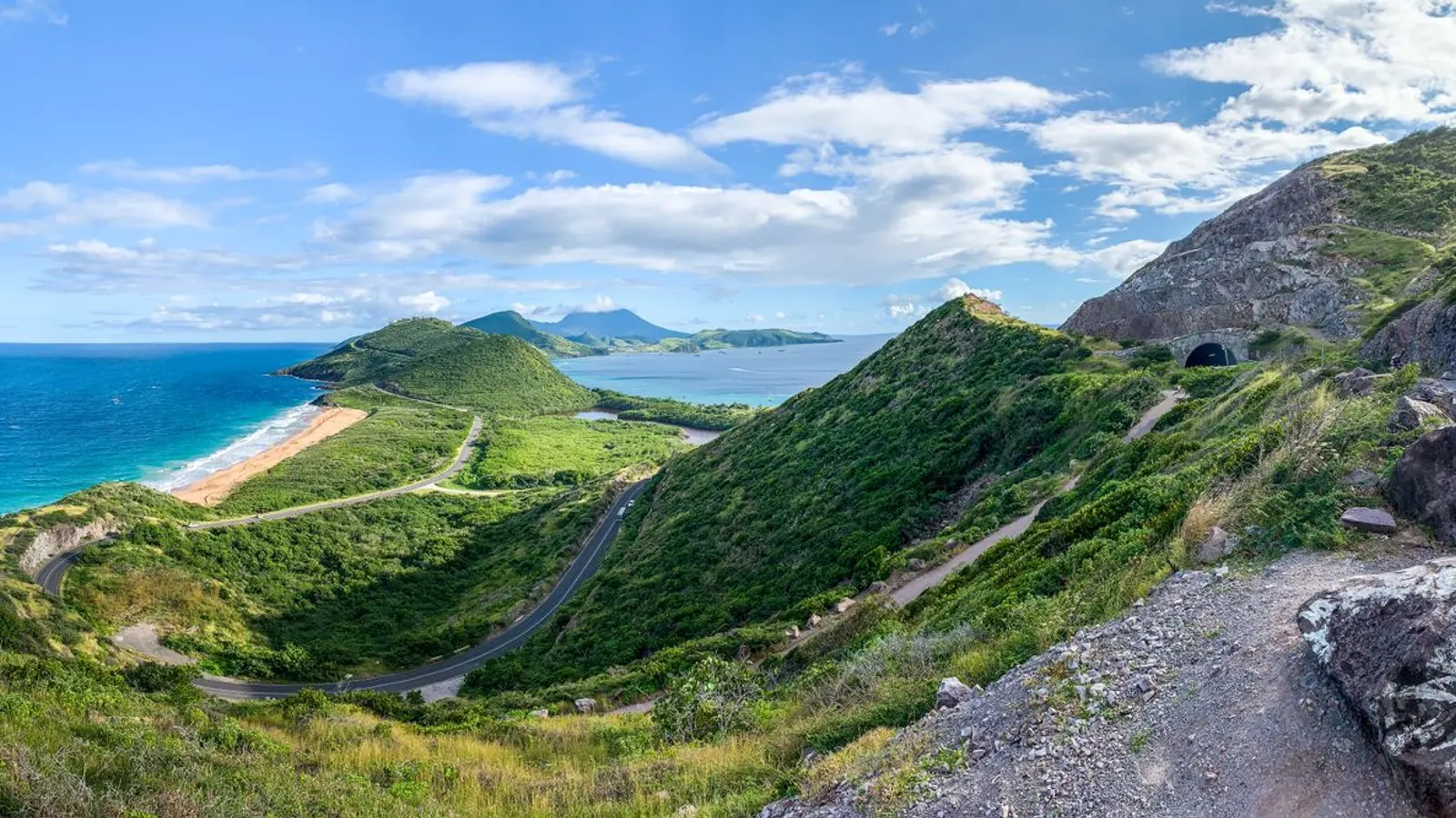
Back on the first ferry and straight out to the tail of Saint Kitts. Until the Dr Kennedy Simmonds Highway opened in 1989 this peninsula had no road at all and was reached by boat; it now holds the Great Salt Pond, the island's resort development and its best beaches. The lookout at Timothy Hill has the Atlantic on one side of the ridge and the Caribbean on the other from the same spot. Cockleshell Bay at the end looks straight across the Narrows at Nevis Peak, three kilometres off, with Booby Island in the middle of the channel. The vervet monkeys along the road are descendants of animals brought from West Africa with the French in the seventeenth century, and they are a farming problem rather than a curiosity. No minibus comes down here - taxi, hire car, or nothing. The airport is on the other side of Frigate Bay, about half an hour back up the highway, which makes this a workable last day if your flight goes in the evening and a rushed one if it does not.
Good to know
Most European, North American and Commonwealth passport holders need no visa for stays of up to three months, but immigration asks for an onward ticket and an address. The currency is the East Caribbean dollar, pegged at XCD 2.70 to the US dollar since 1976 and shared with seven other members of the Eastern Caribbean Currency Union - US dollars are accepted everywhere at a rounded rate that is never in your favour, so change money or draw EC from an ATM. Cards work in Basseterre, the hotels and the larger supermarkets; the minibuses, the beach bars, the market and most of Nevis outside the inns are cash. Driving is on the left and a visitor cannot use a foreign licence: you must buy a local temporary permit, currently about EC$62.50, which the rental agency issues on the spot against your home licence - confirm the current fee and how long it runs when you book, and factor it into the car-hire quote rather than being surprised at the desk. Shared minibuses (plates beginning with H; taxis begin with T) run the ring road on both islands for a couple of EC dollars, are frequent on weekday mornings, thin out badly after dark, and are close to non-existent on Sundays; they do not serve the south-east peninsula at all. The passenger ferries between Basseterre and Charlestown take about forty-five minutes and cost roughly EC$25 each way, with several sailings a day and a reduced Sunday timetable - schedules are posted at the terminals rather than reliably online, so confirm the last boat on the day you plan to use it. A vehicle ferry has run intermittently between Major's Bay on the peninsula and Cades Bay on Nevis; treat it as a bonus, not a plan. Both mountain climbs want a guide, and on Nevis Peak that is not a formality - the fixed-rope sections are genuinely awkward and rescues off that mountain are difficult. Hurricane season runs 1 June to 30 November with the risk concentrated from mid-August to early October; Hurricane Georges did serious damage here in 1998 and the islands have been on the edge of several storms since. The dry months from December to April are the reliable ones, and they are also when the two big festivals fall on opposite sides of the calendar: Saint Kitts holds its carnival, Sugar Mas, from late December into the first days of January rather than before Lent, while Nevis keeps Culturama over the emancipation holiday at the end of July and start of August. Water is the quiet constraint - Saint Kitts draws most of its supply from the Basseterre Valley aquifer and dry-season restrictions are routine, so do not expect long showers in a guesthouse. Electricity is 230V at 60Hz on British three-pin sockets, an unusual combination that catches out both European and American appliances.
Shorter or longer?
Give Nevis three more days and it stops being an afternoon. The Upper Round Road takes a full day on foot around the base of the mountain through the old estate boundaries; the heritage sites on the windward side - New River, Coconut Walk, the Nevisian Heritage Village at Gingerland - take another; and the third goes to the water at Oualie and the reef off Booby Island. Add the Saint Kitts Scenic Railway, the 1912–26 cane line that survived the industry it was built for, on the way back.
Basseterre, Brimstone Hill, Mount Liamuiga and the peninsula, with no ferry and no second island. It is a coherent short trip and it removes the half of the country that has its own premier, its own assembly and a long-standing argument with the other half - which is most of what makes this a federation rather than an island.
Practical guide
Visa check for this route
Budget
Mid-range · per person · sharing a double room. Excludes international flights - they depend on where you fly from.
Editorial estimates · checked August 2026
Country guides
Trip essentials
The connectivity placement is our own eSIM store. No affiliate link on this list. How we choose these →