Itinerary · Africa · 14 days · Moderate
North to the River, South by Sea
Dakar→Île de Gorée→Saint-Louis→Djoudj National Bird Sanctuary→Guet Ndar, Saint-Louis→Touba+8 stops
Dakar and Gorée, then up the coast to the mouth of the Senegal at Saint-Louis and the four-metre cut that rearranged it, inland to Touba - a city of over a million run by a Sufi brotherhood - down through the shell mounds and bolongs of the Saloum delta, and out on the overnight boat to Casamance, which is how the rest of the country reaches its own far south.
Dakar
Arrive, get a SIM and some cash, and spend the day in the city rather than driving out of it. The Musée des Civilisations Noires opened in December 2018 on a scale nothing else in West Africa matches and is still half-empty by design, because the collection it was built for is largely in European museums. Afterwards the IFAN museum, and Soumbédioune at dusk when the pirogues come in.
Gorée
The chaloupe runs from the terminal beside the port and takes about twenty minutes. The island is car-free, roughly 900 metres long, and was inscribed by UNESCO in 1978. Go to the Maison des Esclaves and then read the argument about it: historians dispute how many captives were actually shipped from Gorée, which was a small point of embarkation next to Ouidah or the Bight of Biafra. The dispute is about numbers, not about what the trade was, and the island is the place where West Africa chose to put the memorial.
North to Saint-Louis
Up the N2 through Thiès, Tivaouane and Louga, with the Niayes market-garden belt on the seaward side supplying most of what Dakar eats. Saint-Louis sits on an island in the river mouth, was the capital of French West Africa until 1902 and of Senegal itself until 1957, and went on the World Heritage list in 2000. Cross the Faidherbe bridge, opened in 1897, and walk the grid before dark.
Djoudj
An hour and a quarter north, the last stretch on piste. Roughly 16,000 hectares of flooded plain, UNESCO-listed in 1981, and the first fresh water a Palearctic migrant meets after the Sahara - pelican, flamingo, garganey and several hundred thousand others between about November and April. Go by pirogue at first light. Notice the Typha reed choking the channels: the Diama dam downstream, finished in 1986 to keep salt water out of the irrigation schemes, turned the lower river fresh and the reed has been winning ever since.
Guet Ndar and the breach
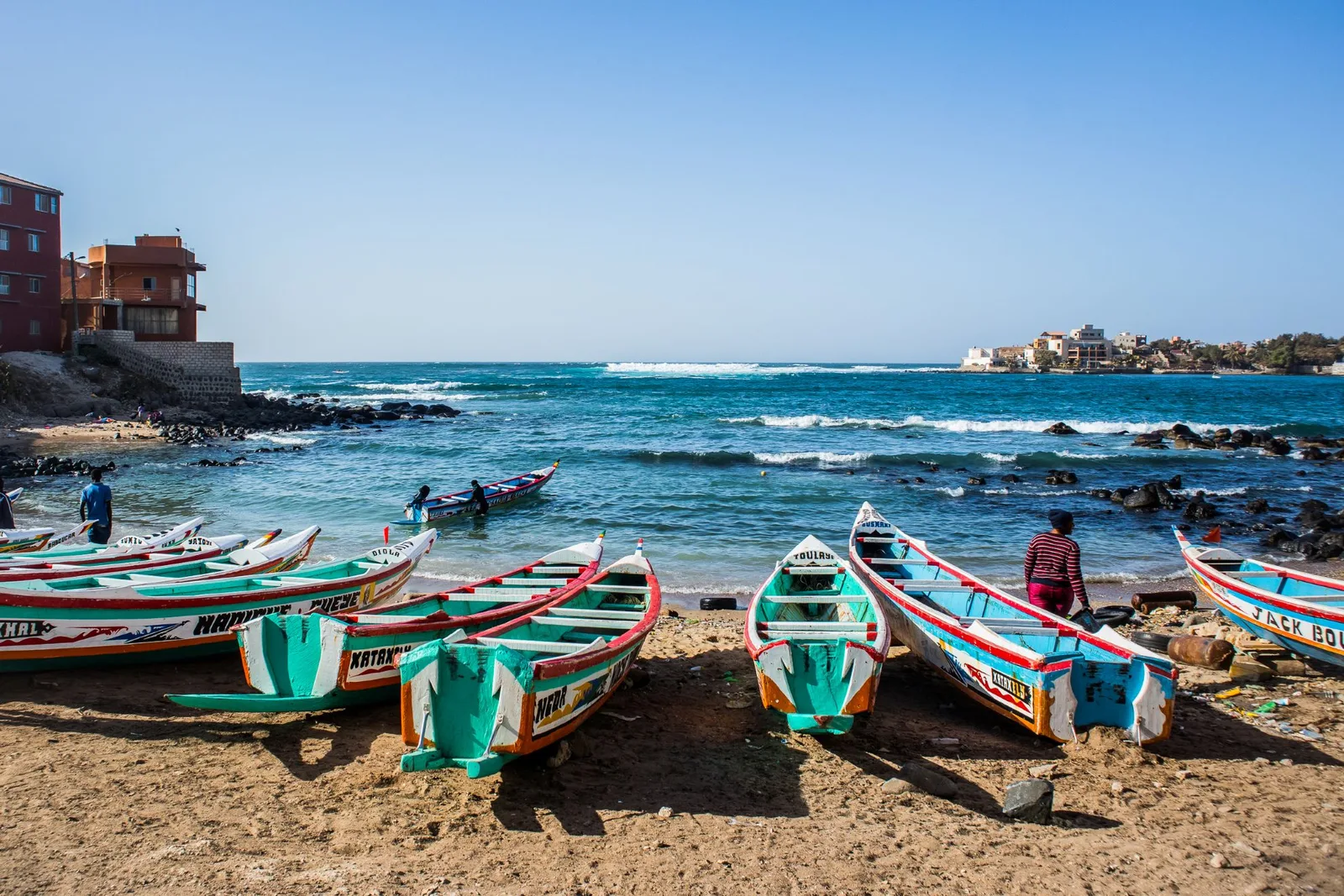
Cross to the Langue de Barbarie, the sand spit that holds the river off the Atlantic. Guet Ndar is the fishing quarter, one of the most densely built places on this coast, and the beach in front of it is the boatyard, the market and the road. Then take a pirogue south to the breach cut through the spit on 3 October 2003 - four metres wide that day, several kilometres now. The village of Doun Baba Dièye is under it. This is the single most legible piece of coast in Senegal and the subject of the feature that goes with this route.
Inland to Touba
South-east through Louga and Kébémer into the groundnut basin. Touba was founded on a vision Cheikh Amadou Bamba had in 1887, and the mosque over his tomb was inaugurated on 7 June 1963 with President Senghor present. The 2023 census counted 1,120,824 people, which makes it the second city of Senegal. There is no bar, no cigarette and no music in the city: the Mouride khalifate sets the rules, allocates the land and runs much of what a municipality elsewhere would run. Dress covered, ask before photographing, take your shoes off well before you think you need to.
Down to the Saloum
Through Diourbel and Kaolack, which is the salt town and holds one of the largest covered markets in West Africa, then south-west to the edge of the delta at Toubacouta. The Saloum Delta went on the World Heritage list in 2011 and not for the birds: it is listed for the shell mounds, hundreds of them, built up over roughly two thousand years of oyster and cockle harvesting, some carrying burial tumuli on top.
The bolongs
A full day in a pirogue on the tidal creeks - the bolongs - between mangrove walls that close over the boat at high water. Île aux Oiseaux carries what is reckoned the largest royal tern colony anywhere, of the order of forty thousand pairs, plus Caspian terns, slender-billed gulls and African spoonbills; it is a sandbank for most of the year and a city from about April, so a dry-season visit sees the site rather than the birds. Then the shell mounds at Dionewar and Falia, and the oyster women working the mangrove roots at low tide, which is the delta economy in one image. Go out early: the wind gets up by mid-morning and the boatmen would rather be back.
Palmarin
North across the delta through Sokone, Fatick and Fimela to the strip of dune, salt pan and savanna between the Saloum and the sea. The reserve here - 10,430 hectares, created by the rural council of Palmarin in May 2001 rather than by the state - is run by the villages inside it, with eco-guards paid out of visitor fees and lodge revenue and salt harvested off the tannes the rest of the year. It holds spotted hyena, jackal and a great deal of birdlife on the pans. From the end of the road at Djifer you look across at the tip of the Sangomar spit, which a storm cut through in 1987 and which has been an island since - the same thing that happened at Saint-Louis, sixteen years earlier and without anybody deciding it.
Joal-Fadiouth, then the boat
Half an hour up the coast, Fadiouth is an island made of clam shells joined to the mainland by a wooden footbridge, with a second shell island beside it holding a shared Christian and Muslim cemetery. Léopold Sédar Senghor was born in Joal in 1906. Then straight to Dakar to board the Ziguinchor boat, which leaves at eight in the evening; be at the maritime terminal by six with the passport whose name is on the ticket. The boat sails from Dakar on Tuesdays and Fridays only, so this is the day the whole route is built backwards from - fix it first and count out from it.
Ziguinchor
Fifteen hours down the coast and up the Casamance river, docking late morning. The town is low, red-earthed, mango-shaded and slower than anywhere north of it; the language on the street shifts to Diola, the churches outnumber what you have got used to, and the market at Saint-Maur is worth an afternoon. Sort the onward transport today rather than tomorrow.
Enampor and Oussouye
West into Diola country. Enampor has the best-known case à impluvium - a circular clay house built around a central opening that funnels the rains into a cistern inside the building, which is an answer to a wet season and a dry one at the same time. Oussouye still has a king: Sibiloumbaye Diédhiou was enthroned in 2000 in a role that is religious rather than administrative and older than any border here.
Elinkine and Carabane
Down to the fishing jetty at Elinkine and across by pirogue to Carabane, an island at the river mouth that France took in 1836 as its first foothold in Casamance and ran as the regional capital before abandoning it. What is left is a brick church with a tree growing through it, a Breton-built mission, a cemetery and a few hundred residents - under 800 at the last count, against more than 1,500 before the droughts, the insurgency and the loss of the Joola emptied it out. Stay the night if there is a bed: the last boat back is early and the island after dark is the point.
Cap Skirring and out
Back over the water and west to the coast. Cap Skirring is a long open beach with a shore break that catches people out, and Diembéring and Kabrousse either side of it are villages rather than resorts. Fly north from the airstrip here - about an hour and ten minutes - or from Ziguinchor, which has more departures. Overland back to Dakar means the Trans-Gambia road and the Senegambia bridge, and it is a long day.
Good to know
No visa is needed for EU, UK, US, Canadian or Australian passports for stays up to 90 days - Senegal dropped the requirement in 2015 - but the passport must have six months left on it. Senegal formally demands a yellow fever certificate from anyone arriving from a country with a risk of transmission, an airport transit of more than twelve hours in such a country counts, and the south-east of the country is itself in the risk zone, so for a trip that includes Casamance or Kédougou the practical answer is to carry the card; since 2016 it is valid for life and no state may require a booster. Malaria is the real medical question and it is year-round nationwide, rising sharply in the rains and highest in the Saloum delta and Casamance, so most travel clinics will prescribe prophylaxis for the whole fourteen days rather than for part of them. The hivernage runs roughly late June to October and is not the same event everywhere: Saint-Louis gets a few hundred millimetres, Ziguinchor several times that, and it is the Casamance side roads and the delta pistes that dissolve, not the N1 or the N2. Djoudj is worth the drive between about November and April and thin outside it. The Dakar–Ziguinchor ferry is run by COSAMA and sails from Dakar on Tuesdays and Fridays at 20:00, returning from Ziguinchor on Thursdays and Sundays at 13:00, about fifteen hours each way; fares run from roughly 16,000 CFA for a pullman seat to about 31,000 for a two-berth cabin, booking opens around a month ahead and it sells out, and the name on the ticket is checked against the passport at the gate. That check is not paperwork for its own sake: the MV Joola, the ferry this service replaced, capsized off the Gambian coast on 26 September 2002 carrying far more people than her licence or her manifest allowed, and at least 1,863 died - one of the worst peacetime losses at sea anywhere. Every Casamance family has a version of that day, and the counted manifest is what came out of it. In Touba, alcohol, tobacco, music, dancing and games are prohibited across the whole city and the rule is enforced by the community rather than the police - cover up, and avoid the Grand Magal unless it is the reason you came, because it moves about eleven days earlier each year with the Islamic calendar and fills every room for a hundred kilometres. Casamance carried a low-level MFDC insurgency from 1982 onwards; an agreement with César Atoute Badiate’s faction was signed in Bissau on 4 August 2022 and a fuller disarmament and reintegration deal followed there in February 2025, the Ziguinchor–Oussouye–Cap Skirring axis is routine, and the residual hazard is unexploded ordnance and mines in the bush near the Guinea-Bissau border, which means staying on made tracks there and not wandering into unused ground. Skipping the boat and going overland to Casamance means crossing The Gambia on the Trans-Gambia road at Farafenni and over the Senegambia bridge - two exit and two entry formalities each way, plus bridge and vehicle charges, for a country you never stop in. The currency is the CFA franc, pegged to the euro at 655.957, so the conversion is exact; cards work in Dakar and almost nowhere else, and Wave and Orange Money are how the country actually pays for things. Self-drive is realistic on the tarmac and pointless in the delta - most people take a car with a driver for the northern loop and sept-place Peugeot bush taxis between towns, which leave when the seventh passenger arrives and not before. Do not drive after dark anywhere: unlit carts, livestock and stationary lorries are the standing reason.
Shorter or longer?
Add five or six days from Kaolack: Tambacounda, then Niokolo-Koba, which UNESCO removed from the danger list in July 2024 after seventeen years on it, and on to the hills around Kédougou, Salémata and Bandafassi - Bassari, Bedik and Fula villages listed as a cultural landscape in 2012. Dry season only.
Dakar, Gorée, Saint-Louis, Djoudj, the breach, then the Saloum and Joal on the way back. Keeps the estuary and the mangroves, cuts Touba, the overnight boat and all of Casamance - which is also most of the transport cost.
Practical guide
Visa check for this route
Budget
Mid-range · per person · sharing a double room. Excludes international flights - they depend on where you fly from.
Editorial estimates · checked August 2026
Country guides
Trip essentials
The connectivity placement is our own eSIM store. No affiliate link on this list. How we choose these →