 Alex Arcuri · Pexels License
Itinerary · Oceania · 12 days · Moderate
The Volcano and the Wreck
Port Vila→Lelepa Island→Havannah Harbour→Lenakel, Tanna→Mount Yasur→Port Resolution+6 stops
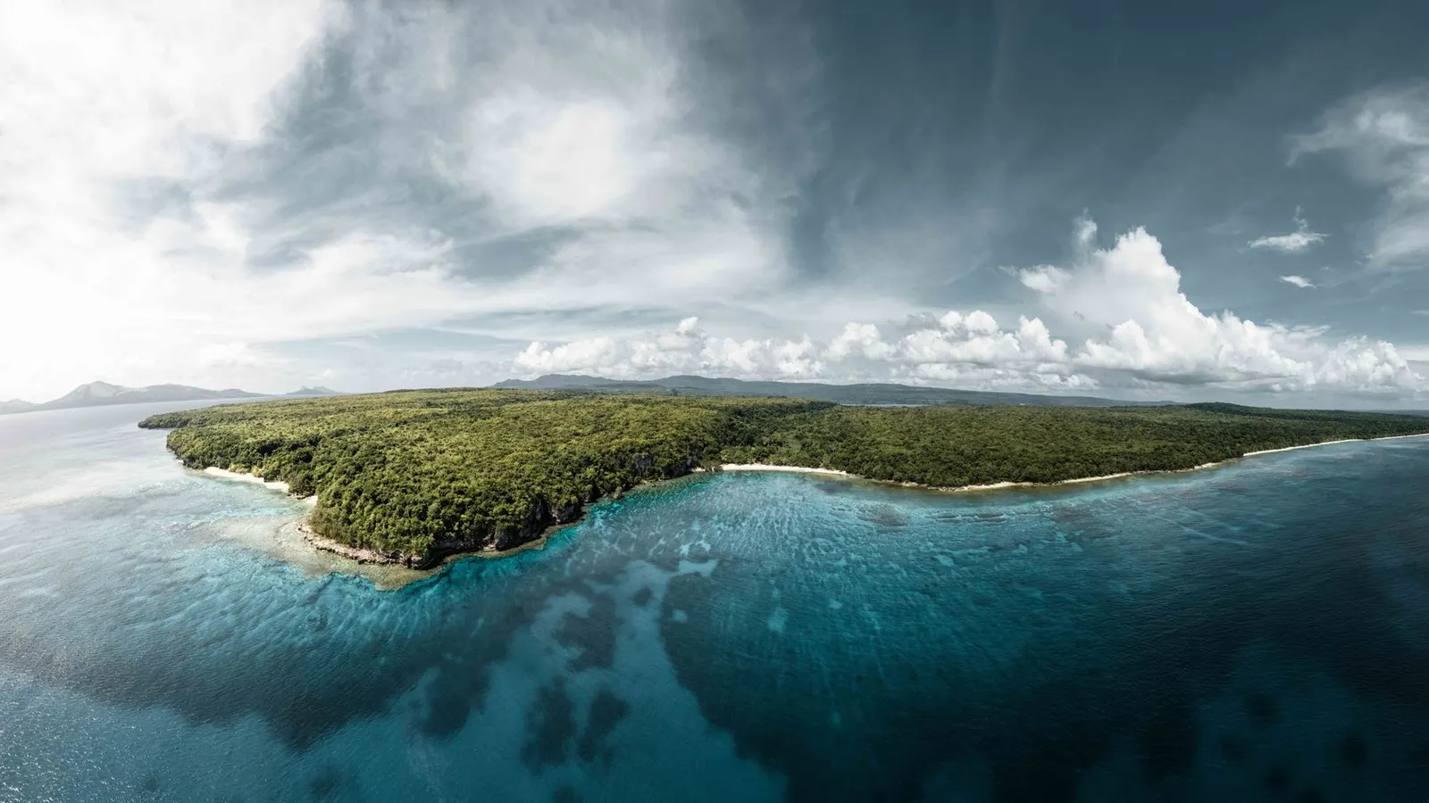
Three islands and four domestic flights: the only World Heritage site in the country, a chief's burial island you are shown from a boat and not allowed to land on; a crater on Tanna you are allowed to stand on the rim of when the alert level permits; and a 200-metre troopship lying off a beach in Espiritu Santo that you can swim to. Almost every place on this route is privately owned custom land, and almost every one of them charges.
Port Vila
Land at Bauerfield and take the day slowly. Buy a SIM, draw vatu, and walk the seafront and the produce market, which opens on Monday morning and does not close again until Saturday midday, and where the vendors sleep under the tables. The town centre still carries the December 2024 earthquake: a magnitude 7.3 offshore of Efate killed at least fourteen people, condemned buildings in the central business district and closed the main wharf, and the rebuild has been uneven. Some of what a guidebook lists is gone.
Chief Roi Mata's Domain
North-west along the ring road to Mangaliliu, then across by boat to Lelepa. Roi Mata was a paramount chief who died around 1600 and whose burial on Artok island was known only from oral tradition until the French archaeologist José Garanger excavated it in 1967 and found the chief and some fifty others exactly where the accounts said they would be. Inscribed by UNESCO in 2008, it is the only World Heritage site in Vanuatu. The land is customarily owned, the guides are from the villages that own it, and Artok itself is tabu ground you are shown from a distance.
The ring road
Efate's loop is about 132 kilometres of sealed road and takes a day with stops. Mele Cascades first, then north past Havannah Harbour, which was the anchorage for the American fleet from 1942 - Efate was the first US base built in the New Hebrides and the concrete is still in the bush. Round the top, down the east side to Eton, and back into town. A hired car is worth it for this one day; the shared minibuses only really work inside Port Vila.
Fly south to Tanna
Forty-five minutes down to White Grass on the west coast, over the length of Erromango on the way and open water either side of it. Tanna is small, green and steep, and the road network is largely unsealed. Spend the afternoon at Lenakel, the island's only town and the place the produce boats come into, and get the volcano arranged for tomorrow through wherever you are staying - it is a 4x4 transfer, not a walk.
Mount Yasur
Across the island by 4x4, then over the Siwi ash plain, which is grey, treeless and floods after rain into something a vehicle can be lost in. The last stretch is a short climb to the rim, and from there you watch strombolian explosions throw lava bombs a few hundred metres away with nothing between you and them. Go at dusk. Access is set by the alert level published by the geohazards department and it is enforced at the barrier, not negotiated at the barrier.
Port Resolution and Sulphur Bay
Cook anchored in the bay in August 1774 and named it after his ship; the 1878 earthquake lifted the shoreline several metres and left the old landing high and dry. Along the coast at Sulphur Bay the John Frum movement has kept its own calendar since the 1940s - a flag raised each morning, a cross painted red, and a February date every year that commemorates a promise nobody has been able to date precisely. It is a living church rather than an exhibit, and you visit by asking first and paying the village.
North to Espiritu Santo
The transfer day, and the one that decides whether the rest of the route holds. There is no service between Tanna and Santo: you fly back into Port Vila, wait, and fly north again, roughly an hour on the second leg. Arrive at Luganville, which is a single long street laid out by the Americans and never much altered. Eat at the roadside kitchens by the market.
The Coolidge and Million Dollar Point
The President Coolidge was a luxury liner requisitioned as a troopship and she hit two American mines at the entrance to the channel in October 1942. The captain ran her aground to get 5,340 men off - all but two survived - and she slid back and settled on her side. She lies from about 20 metres at the bow to 70 at the stern, a swim off the beach, and is generally called the most accessible large wreck dive in the world. Afterwards, Million Dollar Point, where the Americans bulldozed their surplus into the sea in 1945 rather than sell it cheaply, and you snorkel over jeeps.
The blue holes
North up the east coast road to the freshwater springs in the forest - Matevulu and Riri are the two usually visited, reached by a track off the highway or by paddling up from the river mouth. The colour is a function of depth and limestone, not of anything added, and it is startling in a way photographs handle badly. Each hole is owned by a family who take a fee at the gate. Oyster Island, a few minutes offshore by the resort's own boat, is a decent lunch stop.
Champagne Beach and Port Olry
Fifty-odd kilometres north on a road that alternates between good seal and bad gravel. Champagne Beach is a white sand bay that charges an entry fee per person and a separate one per vehicle, collected by the landowners at a gate on the track. Port Olry, ten kilometres further, is a Francophone Catholic village at the end of the road with better food and no gate. Ask locally before this drive if it has rained hard.
Millennium Cave
Inland from Luganville, a full day run by the villages that own the ground. A drive, then an hour on a bush track and bamboo ladders, then a wade through a river cave in the dark behind a guide with a torch, then a float and a scramble down a canyon back out. It is genuinely strenuous and it is genuinely wet - everything you carry gets soaked. Book the day before through the village office rather than turning up.
Back to Port Vila
The hour-long hop south, deliberately a day before any international departure rather than the morning of it. If the flight goes as scheduled you have an afternoon: the National Museum for the sand drawings, which are a registered UNESCO intangible heritage practice and are demonstrated rather than displayed, and the handicraft market for the last of the vatu.
Good to know
Most nationalities get thirty days visa-free, stamped as a visitor permit on arrival; you need six months of passport validity and a confirmed onward ticket, and an extension is applied for at the Immigration office in Port Vila rather than at the border. The domestic air network is the single point of failure on this route. Air Vanuatu went into liquidation in May 2024 and stopped flying overnight; the liquidation was terminated that October and the airline handed back to its own management, but it has flown since on a reduced fleet - schedules are revised at short notice, cancellations are ordinary rather than exceptional, and there is no alternative carrier on most sectors. Book the domestic legs early, reconfirm each one the day before, and put at least one clear day in Port Vila before an international departure. There is no Tanna–Santo service: everything routes through Port Vila. Mount Yasur is governed by an alert level published by the Vanuatu Meteorology and Geo-hazards Department on a scale of 0 to 5, and the number that gets misread is 2. Yasur has sat at level 2, major unrest, continuously since October 2016, and level 2 still permits the rim - what shuts the mountain is level 3, when the danger zone widens from the vents to the whole cone. The barriers are staffed and no operator will take you past them. Read level 2 as open rather than as safe: the department's own wording is that no viewing position on the rim is without risk, and it is ballistics rather than lava that hurt people there. Almost every natural site in this itinerary - beach, blue hole, cave, viewpoint - sits on customary land, because the constitution vests all land in the indigenous custom owners. The fees you pay at gates are rent, not a tourist tax, and photographing people or villages needs asking. Carry cash: there are reliable ATMs in Port Vila and Luganville, and one at Lenakel on Tanna that is regularly empty or out of service with nothing behind it, so draw for the whole Tanna leg before you fly south. Card machines outside the resorts depend on a connection that often is not there. Cyclone season runs November to April and Vanuatu is among the most exposed countries on earth to it; the December 2024 earthquake is a reminder that the other hazard has no season at all. Malaria is not a countrywide question and the answer differs by island on this route: Efate has had no local transmission for years and Tafea province, which is Tanna, has recorded none since 2014, while Sanma province - Espiritu Santo - carried around seventy per cent of the country's roughly two thousand confirmed cases in 2025. Prophylaxis is therefore a decision about the Santo leg specifically, and one to take with a travel clinic rather than from an itinerary. Insure for evacuation to Australia or New Zealand, because anything serious will mean exactly that. Bislama, English and French are all official; Bislama is the one everybody actually shares, and it rewards ten minutes of effort. Tipping is not customary and bargaining at the market is not either.
Shorter or longer?
Between April and June, add three or four days for the land dive on Pentecost - men jumping from wooden towers with vine tethers as a yam-harvest rite, and the ancestor of bungee jumping. Flights to Lonorore are small, infrequent and weather-dependent, so allow slack at both ends and treat the date as approximate until the tower is built.
Efate and Tanna only: Port Vila, Roi Mata's Domain, the ring road, then four days on Tanna for Yasur and Port Resolution. Cuts the Coolidge and everything north, and reduces the flying to two sectors instead of four.
Practical guide
Visa check for this route
Budget
Mid-range · per person · sharing a double room. Excludes international flights - they depend on where you fly from.
Editorial estimates · checked August 2026
Country guides
Trip essentials
The connectivity placement is our own eSIM store. No affiliate link on this list. How we choose these →