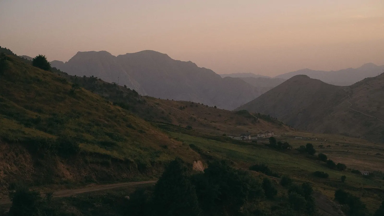
 ZUMRAD NORMATOVA · Pexels License
Country Guide № 170 / 194 · Asia
Tajikistan
The Pamir Highway, and not a great deal else that is easy.
“The Pamir Highway, and not a great deal else that is easy.”
Tajikistan is the poorest and most mountainous country in Central Asia, and its main draw is a road. The Pamir Highway runs from Osh in Kyrgyzstan to Dushanbe across the Pamir plateau, over passes above 4,600 metres, past the Afghan border along the Panj river and through the Wakhan corridor. It takes a week to ten days and is one of the great overland journeys anywhere.
Everything else is harder. Infrastructure outside Dushanbe is thin, the Pamirs require a special permit on top of the visa, and the political situation in the autonomous eastern region has produced periods of restricted access. The Fann Mountains near Samarkand are the accessible alternative - turquoise lakes and 5,000-metre peaks, three hours from Dushanbe and no permit needed.
Chapter 01
Highlights
The Pamir Highway
The M41 from Osh to Dushanbe over the 4,655-metre Ak-Baital pass, past Karakul lake and along the Afghan border. Shared 4×4 or hired vehicle, seven to ten days, and a GBAO permit.
The Wakhan corridor
The lower branch of the Pamir route, following the Panj river with Afghanistan on the far bank and the Hindu Kush behind it - fortresses, hot springs and Ismaili shrines.
The Fann Mountains
Turquoise lakes below 5,000-metre peaks between Dushanbe and Samarkand - the Haft Kul chain and Iskanderkul. Trekking without permits and the easiest mountains in the country to reach.
Yagnob valley
A remote valley whose villages still speak a direct descendant of Sogdian, the Silk Road language. Reached on foot or by 4×4 and rarely visited.
Chapter 02
Entry requirements for Tajikistan
Checking your passport…
up to 30 days · free entry
30 days on arrival
Before you fly
The detail
- Maximum stay
- up to 30 days
- Fee
- free entry
- Passport validity
- Most destinations want validity beyond your stay, and some want six months. Check yours against the return date.
- Onward travel
- Airlines may ask for a return or onward ticket at check-in.
- Arrival form
- E-visa approval printed, with the GBAO permit endorsement if you are heading to the Pamirs.
- Health
- Hepatitis A and typhoid standard, rabies worth considering, tick-borne encephalitis for spring and summer mountain travel. Altitude illness is the dominant risk on the Pamir route. Do not drink untreated water. Medical facilities outside Dushanbe are minimal and Khorog's hospital is the only one of consequence in the Pamirs - evacuation means a long drive or a weather-dependent flight. Insurance covering high altitude and evacuation is essential and should be read carefully for altitude caps.
- Money
- Cash, almost entirely. ATMs in Dushanbe and Khujand accept foreign cards; Khorog has a couple that are unreliable, and beyond that there are none for hundreds of kilometres. Carry US dollars to change and enough somoni for the whole Pamir leg. Cards work in a few Dushanbe hotels and nowhere else. Bring more cash than you think you need - this is the country where running out actually strands you.
A United States passport is on Tajikistan's visa-free list - up to 30 days, nothing to buy and nothing to file. The list runs to around fifty countries, was adopted comparatively recently, and is worth carrying evidence of: an airline check-in desk or a land-border officer who last looked at the rules a few years ago may not know it, and a printout of the ministry's own list has settled that argument for other travellers before now. The e-visa at evisa.tj remains available to anyone who would rather not have the argument at all, at about US$50 for 45 days, issued in two to five working days. Central Asia is not one visa area. Kazakhstan, Kyrgyzstan, Uzbekistan, Tajikistan and Turkmenistan each answer for themselves, the answers differ by weeks of allowance and by whether anything has to be bought at all, and every border between them is an ordinary international crossing with its own queue, its own opening hours and its own list of who may use it. A joint regional visa on the Schengen model has been announced more than once; at the time of writing none can be bought, so plan each country's entry separately and check the specific crossing rather than the region. There is a specific and expensive catch for anyone going to the Pamirs, and it follows directly from entering visa-free. The GBAO permit - the separate authorisation needed for the whole Gorno-Badakhshan region, which is to say the entire Pamir Highway, Khorog, the Wakhan and Bartang valleys and Kalaikhum - is normally added to the E-VISA APPLICATION for about US$20. Enter without a visa and there is no application to add it to, so the permit has to be obtained inside the country, in Dushanbe, which takes a working day or so and is usually arranged through a guesthouse or a local agency. Without it you are turned back at the checkpoint before Kalaikhum, hundreds of kilometres from anywhere useful. GBAO issuance has been suspended more than once after unrest in the region, so confirm its current status before building a trip around the highway. Registration is not required for stays under 30 days. Apply only on the official evisa.tj domain - the commercial lookalikes are the reason that sentence is here.
Check another destination with this passport →
Entry details: Editorial synthesis - Tajikistan Ministry of Foreign Affairs visa-free list and e-visa portal, GBAO permit guidance (2025–2026) · compiled 18 Sept 2026
Who needs a visa for Tajikistan
12 common passports| Passport | Requirement | Stay | Process |
|---|---|---|---|
| United States | Visa-free | up to 30 days | No process · €0 / $0 |
| United Kingdom | e-Visa | - | e-Visa · €45 / $49 · 2–5 d |
| Germany | Visa-free | up to 30 days | No process · €0 / $0 |
| India | e-Visa | - | No Other passports record yet |
| China | e-Visa | - | No Other passports record yet |
| Brazil | Visa-free | up to 30 days | No Other passports record yet |
| Nigeria | e-Visa | - | No Other passports record yet |
| Indonesia | Visa-free | up to 30 days | No Other passports record yet |
| Philippines | Visa-free | up to 30 days | No Other passports record yet |
| Vietnam | Visa on arrival | - | No Other passports record yet |
| Egypt | Visa on arrival | - | No Other passports record yet |
| Nepal | e-Visa | - | No Other passports record yet |
Holding a passport that is not listed? The picker above answers for any of them. See where your passport takes you. Source: Passport Index, updated 15 Aug 2026.
Chapter 03
When to go
BestJun–Sep. AvoidNov–Mar.
Pamir Highway opens; long days and green valleys.
The band above each month is our editorial verdict - it weighs crowds, prices and access as well as weather. The line is average daily temperature, the bars are monthly rainfall. Select a month for the figures. Climate figures: ERA5 reanalysis via Open-Meteo, 2005–2024 normals.
Chapter 04
What it costs
A day in Tajikistan
Comfortable · sample day
≈ $49
Line items are real prices we track. The daily budget is an editorial estimate for this level, not their sum.
Where this sits among 244 countries we have costed
The Pamir season runs June to September and there is effectively no shoulder - homestays and drivers wind down when the passes close. Vehicle hire is the whole budget for a Pamir trip and is quoted per vehicle, so the per-person figure depends entirely on how many share it. Dushanbe prices are flat year-round.
Updated Aug 2026 · Editorial synthesis - Pamir operator and driver quotations, PECTA homestay rates, e-visa tariff (2025–2026) · confidence medium
Excludes international flights - they depend on where you fly from.
Chapter 05
Regions to know
5Dushanbe & the centre
The capital with its huge flagpole and national museum, and the Hisor fortress an hour west.
The Fann Mountains
Turquoise lakes and 5,000-metre peaks between Dushanbe and Samarkand - the accessible trekking country.
Khorog & the western Pamirs
The regional capital on the Afghan border, with the Wakhan corridor and the Bartang valley branching off.
The eastern Pamirs
The high plateau - Murghab at 3,650 metres, Karakul lake and the Ak-Baital pass toward Kyrgyzstan.
Khujand & the north
The Fergana valley end of the country, older than Dushanbe and closer to Uzbekistan in feel.
Chapter 06
Practical guide
Getting there
Dushanbe (DYU) takes flights from Istanbul, Dubai, Moscow and a handful of regional cities; there are no direct European services. Many travellers arrive overland from Kyrgyzstan on the Pamir Highway or from Uzbekistan near Samarkand, both routine crossings. The Afghan border crossings exist but are not a sensible route.
Entry formalities
E-visa approval printed, with the GBAO permit endorsement if you are heading to the Pamirs.
Getting around
Shared taxis are the backbone - they leave when full from set stands and cover every route. Hired 4×4s with drivers are essential for the Pamirs and the Fann Mountains. Domestic flights connect Dushanbe and Khorog when weather allows, on a spectacular and weather-dependent mountain route. Roads are poor to very poor outside the main corridors and the Anzob tunnel north of Dushanbe, once notorious, is now much improved.
Money & costs
Cash, almost entirely. ATMs in Dushanbe and Khujand accept foreign cards; Khorog has a couple that are unreliable, and beyond that there are none for hundreds of kilometres. Carry US dollars to change and enough somoni for the whole Pamir leg. Cards work in a few Dushanbe hotels and nowhere else. Bring more cash than you think you need - this is the country where running out actually strands you.
Safety
Ordinary crime is low. The specific concerns are the security situation in GBAO, which has seen periods of unrest and restricted access; the Afghan border, which the highway runs along for hundreds of kilometres; and altitude, weather and remoteness on the road itself. Landslides and rockfall close the highway regularly. There have been isolated attacks on foreign cyclists in the past. Check advisories close to departure and take local advice on the ground seriously.
Health
Hepatitis A and typhoid standard, rabies worth considering, tick-borne encephalitis for spring and summer mountain travel. Altitude illness is the dominant risk on the Pamir route. Do not drink untreated water. Medical facilities outside Dushanbe are minimal and Khorog's hospital is the only one of consequence in the Pamirs - evacuation means a long drive or a weather-dependent flight. Insurance covering high altitude and evacuation is essential and should be read carefully for altitude caps.
SIM & internet
Megafon and Tcell SIMs are cheap. Coverage is reasonable in Dushanbe and the valleys, intermittent along the Pamir Highway and absent for long stretches. Wifi exists in Dushanbe and Khorog guesthouses. A satellite communicator is a reasonable precaution for independent Pamir travel.
Chapter 07
Driving
The Pamir Highway is unpaved for long sections, crosses passes above 4,000 metres and has essentially no recovery infrastructure. Fuel is scarce east of Khorog - carry jerrycans. Drivers who know the road are worth every som.
Rules change - verify with an official source before you rent.
ExplWorld VerifiedNo verified partners here yet - all 6 country seats are open.
Become ExplWorld Verified →Chapter 08
Itineraries through this country
Chapter 09
From the Journal
Chapter 10
Before you go
TajikistanChapter 11
Frequently asked questions
What is the GBAO permit and how do I get it?
Gorno-Badakhshan Autonomous Region covers the entire Pamir region, and entering it requires a permit in addition to your visa. It is normally added to the e-visa application for a small extra fee, or obtained in Dushanbe. Without it you will be turned back at the checkpoint outside Kalaikhum. Note that GBAO access has been suspended or restricted at times following unrest - check its current status before building a trip around the Pamirs.
How do people travel the Pamir Highway?
Most hire a 4×4 with a driver in Osh or Khorog and share the cost between three or four passengers - around €60–90 per person per day including fuel and the driver. Shared taxis run parts of the route more cheaply and much less comfortably. Cyclists and motorcyclists do it independently; both need to plan seriously for altitude, fuel and cold.
How high is it and does altitude matter?
A great deal of the route sits above 3,500 metres and Murghab, where you sleep, is at 3,650. The Ak-Baital pass is 4,655. Altitude sickness is common on this road and people are evacuated from it every season. Ascend from the Osh side gradually, spend a night at moderate altitude first, and do not treat a headache at 4,000 metres as nothing.