Itinerary · Asia · 13 days · Challenging
Kabul, Bamiyan and the Lakes
Bagh-e Babur, Kabul→Darul Aman, Kabul→Istalif→Bamiyan→Bamiyan cliffs→Shahr-e Zohak+7 stops
Advisory - travel not recommended · checked 26 Sept 2026
Afghanistan
Foreign ministries advise against ALL travel to Afghanistan. There is effectively no consular assistance, the kidnapping risk is severe, and no government can be counted on to help you leave: departure depends on limited commercial flights and land borders that can close without notice. Standard scores are suspended while this alert is active.
Official advisory →Every advisory in force →Read the advisory first: foreign ministries advise against ALL travel to Afghanistan, there is effectively no consular assistance, the kidnapping risk is severe, commercial evacuation does not exist, and there is no part of the country that an honest reading calls visitable today. This route is published for the day that changes rather than as an invitation for now. It is built on the circuit that was genuinely travelled in the window that opened after 2001 and closed around 2013 - Kabul, the Shomali plain, Bamiyan and Band-e-Amir, the Salang tunnel north to Mazar-i-Sharif and Balkh, and Herat at the far western end - and it stays out of the south and the east, away from Kandahar, Helmand, Nangarhar and the Pakistan border districts, which were never part of it.
Kabul
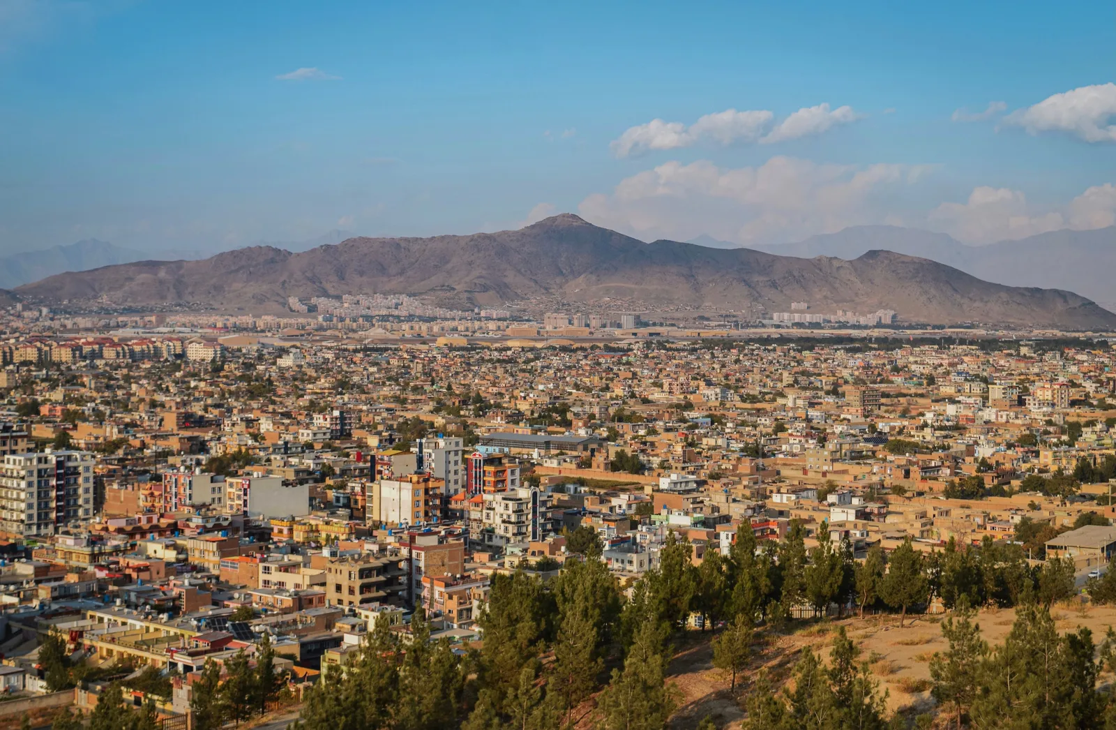
The city sits in a bowl at about 1,790 m (5,870 ft) with mountains on every side, and the first afternoon is best spent in the one place that was never contested. Bagh-e Babur is the terraced garden Babur asked to be buried in - he died in 1530 and was brought here from Agra - and the Aga Khan Trust for Culture rebuilt its water channels, walls and pavilion between 2002 and 2008, working from the description in Babur's own memoirs. Kabulis use it as a park rather than a monument, which is the point of it.
The museum and Darul Aman
The National Museum of Afghanistan lost most of its collection to looting through the 1990s and had its figurative sculpture smashed in 2001; the Bactrian gold from Tillya Tepe survived because staff sealed it into a presidential palace vault in 1989 and told nobody, and it was reopened in 2003. The motto over the door reads that a nation stays alive when its culture stays alive, which was put there after the worst of it. Across the road, Darul Aman palace was built for Amanullah Khan in the 1920s to a German design, shelled to a shell in the 1990s, and rebuilt and reopened in 2019. Then the old city at Murad Khani, where Turquoise Mountain began clearing several metres of accumulated rubbish off the lanes in 2006 and restoring the timber-framed courtyard houses underneath.
Istalif and the Shomali plain
An hour north onto the vineyard plain that supplies Kabul with grapes and mulberries, and up to Istalif on its hillside. The village has thrown and glazed pottery for centuries - the copper-green glaze is its signature - and it was burned to the ground in 1998 during the Shomali campaign, which emptied it entirely. Potters came back from 2002 and the kilns were relit with them. Buy from the workshop rather than the roadside stall, and note that the plain itself is still contaminated ground: stay on tarmac and on tracks other people are visibly using.
West to Bamiyan
A full day on the road, and which road matters. The northern approach runs up through Charikar and the Ghorband valley and over the Shibar pass at about 2,990 m (9,810 ft), and it was the route foreign visitors used through the 2000s; the shorter southern line through Wardak and the Hajigak pass was the first one to become unusable. Nine hours with stops, mostly at walking pace once the surface breaks up. You arrive into a valley floor of irrigated fields at 2,500 m (8,200 ft) with a red cliff along the northern side of it.
The niches
Two empty cavities in the cliff, roughly 55 m and 38 m (180 ft and 125 ft) tall, cut in the sixth and seventh centuries and blown out with explosives over several days in March 2001. What is left is more affecting than a photograph suggests, partly because the caves and painted chapels around them are still there - the ochre and lapis fragments in the ceilings were dated in 2008 to the seventh century, and are the earliest known oil paintings anywhere. The valley was inscribed by UNESCO in 2003 and placed on the List of World Heritage in Danger the same day. Whether to rebuild anything has been argued over ever since, and the argument has never been settled. In the afternoon, Shahr-e Gholghola on its mound above the town, sacked by the Mongols in 1221.
Shahr-e Zohak and the Dragon Valley
East to the red fortress at the confluence of the Bamiyan and Kalu rivers, mud-brick towers on a cliff of the same colour, mostly Ghurid work of the twelfth and thirteenth centuries on much older foundations. The site is a good demonstration of why nobody wanders here freely: it was fought over repeatedly and the clearance is not complete, so this is a guided walk on a known path or nothing. In the afternoon, Dara-e Ajdahar west of the town, where a long fissured ridge of rock is locally the dragon Ali split with his sword.
Band-e-Amir
Seventy-five kilometres (47 mi) west, climbing to about 2,900 m (9,500 ft): six lakes held back by dams of travertine that the water is still building. Band-e Haibat is the big one, and the colour is not an exaggeration of photography - it is what deep water over white carbonate does. The area was declared a national park in April 2009, the first in the country, and it was run by a committee of the fourteen villages inside the boundary. Since August 2023 women have been barred from entering the park, so a mixed group does not do this day or the next one together; settle that in Bamiyan rather than at the gate. Walk the rim rather than the shoreline road, and stay the night - the lakes before the Bamiyan day traffic arrives are the part that justifies the drive.
The upper lakes, and back
A morning between Band-e Haibat and Band-e Zulfiqar on foot, which is a few hours of easy walking on an open plateau with no shade whatsoever - take more water than seems reasonable. The dams are calcium carbonate laid down by springs and they are structurally alive: they grow, they leak, they reseal. Back to Bamiyan in the afternoon, and use the last of the light on the bazaar, which is where the valley's potato crop is traded.
Back over the Shibar
The same nine hours in reverse, arriving in Kabul in the evening. There was a scheduled air link between Kabul and Bamiyan at various points after 2003 - small aircraft, a gravel strip, weather-dependent and repeatedly suspended - and if it is running when you go it removes two of the hardest days on this route. Do not plan around it.
North through the Salang
The road to the north crosses the Hindu Kush in a tunnel about 2.7 km (1.7 mi) long at roughly 3,400 m (11,150 ft), built with Soviet assistance and opened in 1964. Before it, the range closed for the winter and the north was a separate country for five months of the year. The tunnel is unlit in places, badly ventilated, and has killed people in fires and avalanches more than once; it is also the single most consequential piece of infrastructure in Afghanistan. Down the other side through Pul-e Khumri and Samangan onto the plain, and into Mazar-i-Sharif late.
Mazar and Balkh
The Shrine of Hazrat Ali dominates the middle of Mazar: the present building is Sultan Husayn Bayqara's, from about 1480, over a site identified in the twelfth century, and the tiling has been renewed so often that almost none of it is old and the effect is undiminished. Its Nowruz gathering on 21 March was the largest annual assembly in the country, and has been curtailed since 2021. Then twenty kilometres (12 mi) west to Balkh, which was a city when Kabul was not - Umm al-Bilad, the mother of cities, with a circuit of walls you can still trace across the fields, the shrine of Khwaja Abu Nasr Parsa from the late fifteenth century, and Noh Gonbad, a ninth-century mosque of carved stucco piers that is the oldest Islamic building in Afghanistan and has spent the last two decades under a protective shelter and consolidation work.
West to Herat
The direct road runs the northern arc of the ring road through Maymana and Qala-i-Naw and takes two hard days, so this is a flying day: Mazar to Herat with a connection in Kabul, about three hours in the air and most of a day on the ground. Herat is the other end of the country in more than distance - Persian-speaking, closer to Mashhad than to Kabul, and the Timurid capital from 1405 under Shah Rukh, which is why almost everything worth stopping for here is fifteenth-century. Start at the citadel, Qala Ikhtyaruddin, on foundations traditionally traced to Alexander's garrison and restored between 2008 and 2011, reopening to the public at the end of it.
Gawhar Shad and Gazargah
The Friday Mosque was founded by the Ghurids around 1200 and has been retiled by a workshop set up on the premises in 1943 that has never stopped working - the mosaic you are looking at is largely twentieth-century and made by hand fifty metres away. North of the city, the Musalla was Gawhar Shad's complex of madrasa, mosque and tomb, finished in the 1430s and demolished by British engineers in 1885 to clear a field of fire against a Russian advance that never came; five leaning minarets and her ribbed mausoleum are what survived. Finish at Gazargah, the shrine of the eleventh-century poet Khwaja Abdullah Ansari, rebuilt by Shah Rukh in the 1420s, which is where Herat goes on a Thursday evening.
Good to know
Start with the advisory, because nothing else on this page outranks it. Foreign ministries advise against all travel to Afghanistan. There is effectively no consular assistance - most embassies closed in August 2021 and have not reopened - the kidnapping risk is severe, arbitrary detention of foreign nationals has happened repeatedly, and there is no commercial medical evacuation you can simply buy. The honest reading is that no part of the country is visitable today. A small number of operators do run trips, and this route is not an endorsement of them. We publish it because a country we cover should not silently lack a route, and because advisories change.
Insurance is where most people get the arithmetic wrong. An ordinary travel policy excludes a country under an against-all-travel advisory outright: it does not pay less, it pays nothing, including on a claim that has no connection to security. A handful of specialist underwriters write high-risk cover that responds, and for a fortnight it runs into the high hundreds of euros for one person. Read what it actually buys. The clause that matters is medical evacuation, and what you need in writing before you pay is what the underwriter can actually do from inside Afghanistan, not what the policy document promises. The honest answer from most of them is an overland move to a neighbouring country if the border and the roads happen to be open - an air ambulance out is subject to permissions nobody can guarantee in advance.
Visas are issued by Afghan embassies and consulates, of which the working ones for this purpose have been Islamabad, Dubai, Tashkent, Dushanbe and Istanbul; which posts are functioning, and who staffs them, has changed repeatedly since 2021. In practice you need a letter of invitation from a licensed Afghan agency before anyone will look at your application, and the agency also arranges the internal permissions that let you photograph or enter specific sites. Confirm the mechanics the week you travel, not the month you book.
Money is cash. The afghani is the currency and it is used for everything; US dollars are accepted in Kabul and by agencies. Foreign cards do not work anywhere in the country, ATMs will not serve them, and the banking system remains largely disconnected from international correspondent banking under sanctions that target the authorities rather than the country. Bring clean, small-denomination dollars, more than you think, split across more than one place. Sanctions compliance is your responsibility and not your fixer's: check what your own government prohibits you from paying for, and to whom, before you transfer anything.
Mines and unexploded ordnance are the single largest physical risk on this route and they are not concentrated where the fighting was most recent. Afghanistan is among the most heavily contaminated countries in the world, clearance organisations have been working here continuously since 1988, and civilian casualties still run to hundreds a year, a large share of them children. Stay on hard surfaces, stay on paths that other people are visibly using, and never walk into a ruin, a field or a riverbed because it looks empty.
Rules that apply to visitors have tightened since 2021 and apply unevenly by province. Women face a hijab requirement and, in many contexts, a mahram expectation; women have been barred from entering Band-e-Amir since August 2023, and from parks, gyms and public baths more broadly, which means a mixed group cannot complete this route as written. Alcohol is illegal. Photographing people, checkpoints, military installations and government buildings ranges from unwise to a detention. Drones are prohibited outright. Curfews and road closures are imposed locally at no notice.
This route deliberately excludes several things. It does not go south to Kandahar, Helmand or Uruzgan, or east to Nangarhar, Khost and the border districts, none of which were part of the circuit that foreigners actually travelled after 2001. It does not attempt the Minaret of Jam or the Wakhan except as variants, and both of those are separate decisions taken on their own logistics. Check your own foreign ministry the week you travel. This page does not replace it.
Shorter or longer?
Add ten to fourteen days for the far north-east: in by road from Ishkashim, permits arranged in Kabul and stamped again locally, and then a walk-in trek up the Wakhan or the Little Pamir with pack animals hired from Wakhi villages, sleeping in Kyrgyz yurt camps at the top. The corridor was declared Afghanistan's second national park in 2014, it is the one part of the country that stayed largely outside the fighting, and small numbers of trekkers reached it every summer until 2021. It is also four days from any medical help of any kind, which is the reason it belongs in a variant and not in the main route.
Kabul, the road west over the Shibar pass, three days in the Bamiyan valley and at Band-e-Amir, and back. Cuts the Salang, the north and Herat, removes both domestic flights, and keeps the route inside one province and one road corridor with the shortest line back to the capital.
Practical guide
Visa check for this route
Budget
Mid-range · per person · sharing a double room. Excludes international flights - they depend on where you fly from.
Editorial estimates · checked August 2026
Country guides
Trip essentials
The connectivity placement is our own eSIM store. No affiliate link on this list. How we choose these →