Itinerary · Oceania · 15 days · Moderate
Down the Great Divide
Sydney→Parramatta→Katoomba→Blackheath→Berrima→Canberra+9 stops
Sydney to Melbourne with no domestic flight - the southern end of the Great Dividing Range, taken slowly. Sandstone escarpment above the Grose Valley, Walter Burley Griffin's capital, then the mountain country the Snowy Scheme rebuilt: two drowned towns, 145 kilometres of tunnel under the range, the walk to the highest point on the Australian mainland, and the Victorian alpine plains where cattle grazing ended in 2005.
Sydney, from the water
The city is built on Hawkesbury sandstone and you can read it from a ferry: the cuttings at Circular Quay, the pylons of the 1932 bridge, the blocks the Rocks was quarried into. Jørn Utzon won the Opera House in an open competition in 1957, resigned in 1966 after a change of state government and a fight over money, left the country and never came back to see it open in 1973. Take a public ferry to Manly rather than a harbour cruise - same water, a fraction of the price, on an Opal card.
Parramatta
Twenty-four kilometres west of the city, a good deal further by water, and the second place the colony tried to feed itself because the soil at Sydney Cove would not do it. Old Government House was finished in 1799, is the oldest surviving public building in the country, and is one of the eleven Australian Convict Sites UNESCO inscribed in 2010. The Parramatta Female Factory, two kilometres north-east on Fleet Street, held convict women from 1821 and is the larger and less-visited half of the same story - it is a working precinct rather than a museum, so check what is open and whether a tour is running before you walk up. Go up on the RiverCat and come back on the T1 train, which does the return in half the time.
Up to Katoomba
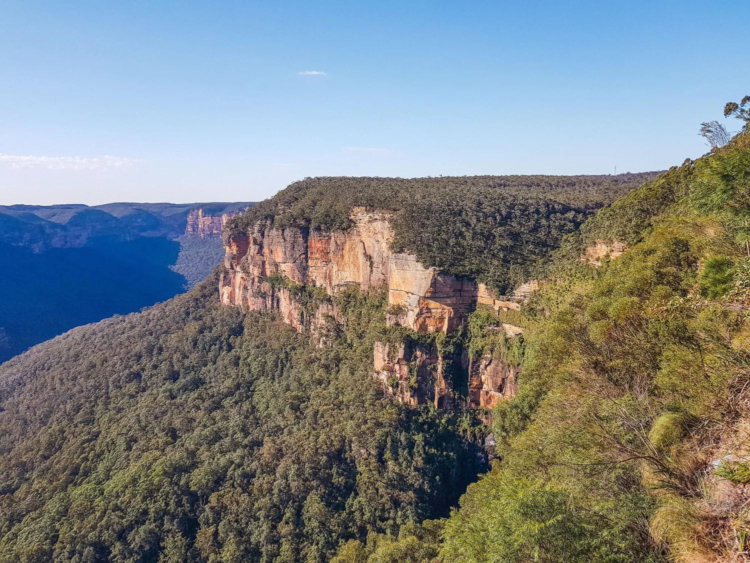
Collect the hire car at Parramatta on the way out, or do the next two days by train - the Blue Mountains line runs from Central to Katoomba in about two hours and every walk below starts at a station or a short taxi from one. This is the eastern edge of the Great Dividing Range and it is a sandstone plateau cut by valleys rather than a line of peaks, which is why the lookouts read as a wall rather than a summit. The Scenic Railway down into the Jamison Valley was built to haul coal and shale out of it and runs at 52 degrees, the steepest passenger track in the world.
Blackheath and the Grose Valley
The Grand Canyon track drops off Evans Lookout into a slot of tree ferns and climbs back out at Neates Glen: six kilometres, three hours, and the best short walk in the mountains. The Greater Blue Mountains was inscribed by UNESCO in 2000 for its eucalypts, and the greater part of the area burned in the fires of 2019 and 2020. The Wollemi pines in the canyon country north of here - a species found alive in 1994 in a location that is still not published - came through that summer because a specialist crew was flown in to irrigate them and lay retardant around the grove.
Berrima and Fitzroy Falls
South on the Hume into the Southern Highlands. Berrima was passed over by the railway in the 1860s and bypassed by the highway in 1989, which is why a Georgian courthouse, an 1839 gaol and a coaching inn are still standing in a row; the gaol held German naval internees through the First World War, who built huts and boats along the Wingecarribee and photographed a very strange captivity. Fitzroy Falls, half an hour south-east via Moss Vale, drops 81 metres off the same sandstone escarpment you spent yesterday walking on, 115 kilometres further south.
Canberra
A city that exists because Sydney and Melbourne could not agree. Walter Burley Griffin and Marion Mahony Griffin won the international competition in 1912 with a plan of axes and a lake, and the lake was not filled until 1964. Parliament House opened in 1988 dug into the hill, with grass ramps over the roof that anyone could walk up until they were fenced in 2017. Give the afternoon to the National Gallery, which paid A$1.3 million for Pollock's Blue Poles in 1973 and spent years being shouted at in parliament for it.
Canberra, along the axis
The Australian War Memorial stands at one end of Griffin's land axis, aimed directly at Parliament House, and is midway through a redevelopment costing more than half a billion dollars, so check which galleries are open before going. At the other end of the same line, on the lawn in front of Old Parliament House, the Aboriginal Tent Embassy has stood since 26 January 1972 and been continuously occupied since 1992. Walk the axis in one direction or the other - the city was drawn to make you do it.
The Monaro to Jindabyne
South-west onto the Monaro, treeless high grassland that looks like nowhere else in the country. Cooma was the Snowy Scheme's headquarters from 1949 and its Avenue of Flags carries the countries the workforce came from; there were more than thirty. The Discovery Centre in town is the free briefing for everything you will drive past over the next four days - check which days it opens before planning the stop. Jindabyne, an hour on, is a town moved uphill in the 1960s because the old one is under the lake.
Kosciuszko
The chairlift out of Thredbo lifts you to about 1,930 metres and the walk to the summit is 6.5 kilometres each way - most of it raised steel mesh, laid to keep boots off alpine soil that takes decades to repair, and the last stretch above Rawson Pass an old gravel road. Kosciuszko is 2,228 metres and the highest point on the Australian mainland, and it is a rounded hump rather than a peak - this is an old, worn plateau, not a young range. Seaman's Hut, a stone refuge below the summit, was built in 1929 by the parents of a man who died up here with a companion in an August blizzard the year before, which is the entire weather briefing in one building: this is winter country from June, and it can turn on you in any month.
North to Talbingo
The Snowy Mountains Highway runs the length of the scheme. Adaminaby was carted building by building to a new site from 1956 as Lake Eucumbene filled behind the dam, and in dry years the old street grid comes back out of the mud; the town it became has a ten-metre fibreglass trout. Kiandra above it was a gold rush of 1859 and the place Norwegian miners are credited with putting Australia on skis - its last standing buildings burned in January 2020. Yarrangobilly has show caves in a limestone gorge - one you walk through alone, the rest by booked tour - and a thermal pool that holds 27 degrees all year, down a steep gravel access road.
Tumut 3 and the Elliott Way
Tumut 3 sits below the wall of Talbingo Dam: six turbines, three of them reversible, running backwards at night to pump water out of the pondage below and back up into the reservoir, and the first large pumped-storage station built in the country. Snowy 2.0 is being dug below and beyond it to link this reservoir with Tantangara. Then south on the Elliott Way through Tumbarumba - narrow, steep, and shut without warning in snow - to Khancoban, a construction town that stayed, and Murray 1, where ten turbines finally let the Snowy's water out on the western side of the range.
Into Victoria
Cross the Murray, which this far up is a stream you could throw a stone across. Corryong keeps the grave of Jack Riley and claims him as the original of Banjo Paterson's Man from Snowy River; historians are not convinced and the town is not troubled by that. Then the long way round, because there is no road over the Bogong massif: west along Lake Hume to Tallangatta, then back south up the Kiewa Valley to Mount Beauty, a town the State Electricity Commission of Victoria built for the workers on its own hydro scheme - begun in 1938, eleven years before the Snowy, and far less celebrated for it. It is the longest driving day on the route and it looks short on a map, which is exactly the trap.
The Bogong High Plains
Up the Bogong High Plains Road past Bogong Village and Falls Creek onto open snowgum country at around 1,700 metres, with Mount Bogong - Victoria's highest at 1,986 metres - across the valley. Cattle were driven up here every summer for more than a century, and the Victorian government ended grazing licences in the Alpine National Park in 2005; the stockmen's huts are still standing and the argument still gets an airing in the Melbourne papers most summers. Back down and over Tawonga Gap into Bright.
Mount Buffalo and Beechworth
Mount Buffalo was made a national park in 1898 and is a granite plateau rather than a mountain, with the Gorge falling away below the Chalet the state built in 1910 and closed in 2007. Walk to the Horn at 1,723 metres, then drop down the Ovens Valley - gold country, and the site of the Buckland riot of July 1857, when Chinese miners were driven off the field by force. Beechworth is the town gold paid for: granite public buildings, the courthouse where Ned Kelly was committed for trial in 1880, and an asylum of 1867 on the hill.
Wangaratta and the train to Melbourne
Drop the car at Wangaratta - thirty-five kilometres, and the last of the driving - and take the V/Line north-east service to Southern Cross, about two hours and forty minutes down the same corridor you have been paralleling since Canberra. Melbourne is the Hoddle grid of 1837 with the laneways cut through it afterwards; the Royal Exhibition Building of 1880 was the first building in the country given World Heritage listing, in 2004, more than twenty years after the reefs and the rock country got theirs. Victoria sold its State Electricity Commission in the 1990s and legislated to bring it back in 2023, which is the argument of this whole route restated in a city.
Good to know
Australia issues no visa-free entry to anyone but New Zealanders, and the permission has to be in hand before you board: EU and UK passports get the eVisitor (subclass 651) free online, most other eligible passports - American, Canadian, Japanese, Singaporean and the rest - need the ETA (subclass 601), which carries a small charge and is granted only through the government's own app, not through the agent sites that rank above it in search results. Driving is on the left, and this route hands you a car on day three. One-way hire is what makes it work and it is where the money goes: a car picked up in Sydney and dropped at Wangaratta or Melbourne carries a relocation fee, it has to be booked as a one-way from the outset rather than arranged on the road, and most Australian rental agreements void cover the moment you leave sealed surface - which matters on the gravel descent to Yarrangobilly and on any detour off the Alpine Way. Kosciuszko National Park charges a daily vehicle entry fee, and between the June and October long weekends every two-wheel-drive vehicle inside the declared snow area must legally carry wheel chains, clear weather or not, hire car or not; Victoria applies the same rule on its alpine roads from the King's Birthday weekend in June to Melbourne Cup weekend in November, and closes the Bogong High Plains Road beyond Falls Creek for that whole season - the drive onto the plains is a summer and autumn day, not a winter one. The Alpine Way between Thredbo and Khancoban and the Elliott Way out of Tumbarumba both close on snow at short notice, the live traffic feed is the only source worth trusting, and a closure adds hours rather than minutes because the detours are enormous. Summer carries the opposite problem: the 2019 and 2020 fires burned through Kosciuszko, the Blue Mountains and the Victorian Alps, whole parks shut on days of extreme or catastrophic fire danger, and a total fire ban is absolute - keep Hazards Near Me and VicEmergency installed and check them before every mountain day. Walking tracks are the other thing that quietly disappears: national parks in both states shut individual tracks for months at a time after storm damage and landslip, so check the park alerts for the Grand Canyon track and anything else you have planned the night before rather than at the trailhead. Fuel and phone signal both thin out between Cooma and Bright, so fill at Cooma, Tumut and Corryong and expect one network to be the only one with anything in the valleys. The Thredbo chairlift runs daily through summer and on a reduced timetable either side of it; the summit walk is above the treeline for its whole length and turns unpleasant quickly, so carry a windproof layer even in January. Book the V/Line service from Wangaratta ahead, and add a night in Melbourne rather than seeing the city between a train and an airport.
Shorter or longer?
Give Melbourne a full day, then fly to Alice Springs - about three hours direct, but roughly one service a day, so book it rather than assume it - and take four or five more for the West MacDonnell ranges, Kings Canyon and Uluru. It is the only honest way to attach the interior to this route: driving it from Melbourne is roughly 2,300 kilometres each way and would swallow the fortnight.
Fly into Canberra, take one day for the city, and run the mountain half only - Jindabyne, Kosciuszko, Talbingo, Khancoban, Mount Beauty, Bright, Beechworth and out through Wangaratta. Cuts Sydney and the Blue Mountains entirely and keeps every part of the Snowy.
Practical guide
Visa check for this route
Budget
Mid-range · per person · sharing a double room. Excludes international flights - they depend on where you fly from.
Editorial estimates · checked August 2026
Country guides
Trip essentials
The connectivity placement is our own eSIM store. No affiliate link on this list. How we choose these →