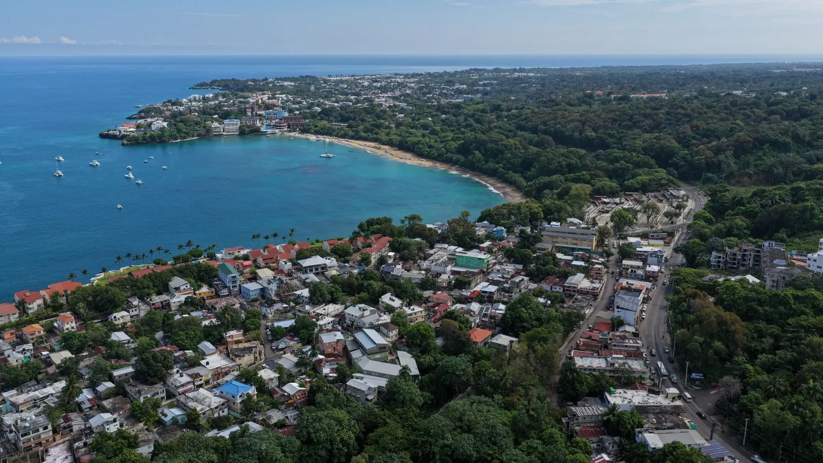
 FELIX CORONA · Pexels License
Itinerary · Caribbean · 12 days · Moderate
The Cordillera and Two Coasts
Zona Colonial, Santo Domingo→Los Tres Ojos, Santo Domingo→Jarabacoa→Río Yaque del Norte, Jarabacoa→Constanza→Valle Nuevo National Park+6 stops
Santo Domingo, then straight up into the Cordillera Central - whitewater at Jarabacoa, a national park topping 2,800 metres where it frosts, the tobacco city of Santiago - and out to the north coast and the Samaná peninsula, where the humpbacks come in winter and the mangrove karst of Los Haitises stands offshore all year. The resort belt at Punta Cana is not on it.
Santo Domingo, the Zona Colonial
The grid was surveyed in 1502 after a hurricane destroyed the first settlement across the river, and it is the oldest continuously inhabited European street plan in the Americas. Walk it in the morning before the heat: the Catedral Primada, finished in 1540; the Alcázar de Colón, built for Diego Colón and rebuilt in the 1950s from ruins; the Calle Las Damas. It is a neighbourhood where people live, not an open-air museum, and the evening on Plaza España is the point.
The twentieth century, and the caves
The Museo Memorial de la Resistencia Dominicana on Calle Arzobispo Nouel covers the Trujillo dictatorship, 1930 to 1961, and it is the most serious museum in the country - three floors, and the torture rooms of the era reconstructed rather than described. Afterwards drive the Malecón east to Los Tres Ojos, a collapsed limestone cavern with four lakes in it, and the Faro a Colón, the concrete cross built for the 1992 quincentenary over a neighbourhood that was cleared to make room for it.
Up the Duarte to Jarabacoa
North on the Autopista Duarte through Bonao, then off it at La Vega and up into the mountains. Jarabacoa sits at about 550 metres in a bowl of pine and coffee, and the temperature difference from the coast is the first thing you notice. Afternoon at Salto de Jimenoa Uno - a suspension footbridge over the river, then a waterfall dropping into a pool you can swim in if the water is not up.
The Yaque del Norte
The longest river in the country starts on the flank of Pico Duarte and drops fast, and the stretch below Jarabacoa is the only whitewater in the Caribbean run commercially - grade II and III most of the year, bigger and more serious after rain, with several operators in town working the same twelve kilometres. Half a day. The rest of it goes on the Salto de Baiguate, which is a short walk in and much quieter than Jimenoa.
Over Casabito to Constanza
Back down to La Vega and Bonao, then west on the paved road that climbs over the Casabito pass - cloud forest, tree ferns, a viewpoint at the top and a descent into the highest agricultural valley in the Caribbean. Constanza sits at about 1,200 metres and grows strawberries, garlic and potatoes under a sky that has nothing tropical about it. Bring a jumper; the nights get down towards single figures and the greenhouses are here for a reason.
Valle Nuevo
The Juan B. Pérez Rancier National Park, universally called Valle Nuevo, starts a few kilometres south of town and climbs to 2,842 metres at the Alto de la Bandera. It is Hispaniolan pine, savanna grass and standing water that freezes: the lowest temperatures ever recorded in the Caribbean were taken here, and frost on the grass at dawn is normal in January. La Pirámide, a stone monument put up in the 1950s to mark the middle of the island, sits at the road junction at about 2,200 metres. The ranger post at the entrance takes the fee. Aguas Blancas - a waterfall of about 80 metres in two drops, on the road south out of Constanza - is the standard afternoon.
North to Santiago
Down out of the mountains and on to the second city, which thinks of itself as the first. Santiago is the centre of the tobacco industry and has been since the nineteenth century - the Centro León, endowed by the family behind La Aurora, is a genuinely good museum of Dominican art and identity with a working cigar-rolling room attached. Climb the Monumento a los Héroes de la Restauración in the evening for the view down the Cibao valley; it was built under Trujillo, in his own honour, and renamed the moment he was shot.
Over the Septentrional, and the waterfalls at Damajagua
The autopista crosses the coastal range to Puerto Plata in an hour and a quarter. Stop short of it at Damajagua, where a guided route climbs a limestone gorge and comes back down it by jumping and sliding through a chain of waterfalls - the community association that runs it took over the concession in the mid-2000s after years of arguing about who should, and the guides are from the villages either side. Tickets are sold for seven, twelve or all twenty-seven falls; the seven is an hour and a half and is what most people are sold, the twenty-seven is a half-day, costs roughly double and wants an early start. Helmet and lifejacket provided; you will be soaked, so leave the camera. In Puerto Plata, the cable car up Pico Isabel de Torres and the Fortaleza San Felipe, finished in 1577.
Through Sosúa to Cabarete
Forty minutes east, through Sosúa, and a different country again. Sosúa is worth naming rather than driving past in silence: it was settled by Jewish refugees the Dominican Republic admitted in 1940 when almost nobody else would, and it is also, in one specific strip around Pedro Clisante, the most visible sex-tourism town in the country - that is what the bars along it are for, and Dominican child-protection agencies and the UN have documented minors in that trade in the north-coast resort towns for thirty years. The beach and the small Museo de la Comunidad Judía are separate from it and are the reasons to stop. Cabarete, further on, is a bay that funnels a thermal wind coming up mid-morning almost every day of the year, which is why the town became a windsurfing and then a kitesurfing centre and why the beach is a working one - schools, repair shacks, and a lot of people who came for a fortnight in the 1990s and are still here. Lessons cost a fraction of what the same hours cost in Europe. Inland, the Parque Nacional El Choco has flooded caves you swim through with a guide.
East to Samaná
The long transfer of the route and a good day out of it. East past Río San Juan - stop at the Laguna Gri-Gri for the mangrove channel - then Nagua, and on to the Bulevar Turístico del Atlántico, which runs along the coast to the neck of the peninsula. Santa Bárbara de Samaná is a small port town on a bay that is, for two months of the year, the reason most people come to this side of the island.
Los Haitises
Across the bay by boat, about forty-five minutes from Samaná harbour. Los Haitises is drowned karst - limestone hills standing out of the water as islands, mangrove channels you enter under the canopy, frigatebirds and brown pelicans nesting on the rocks, and caves at San Gabriel and La Arena whose walls carry Taíno pictographs. It is a national park and you go with a licensed operator or not at all. Take a dry bag; the crossing is wet when the wind is up.
El Limón, and back to the capital
The waterfall at El Limón is a forty-minute walk in, or a mule if you would rather, and it falls about fifty metres into a pool that is cold enough to be a surprise. Out by mid-morning, then down to Sánchez and on to the Autopista del Nordeste, which runs around the head of the bay and back to Santo Domingo - toll the whole way, and the fastest driving of the trip. If the whales are in, spend the morning on the water instead and drive in the afternoon.
Good to know
Most western passports need no visa and the old paper tourist card has been folded into the airfare since 2018, but everyone must file the free electronic E-Ticket at eticket.migracion.gob.do before flying in and again before flying out - one QR code per person per direction, checked at the check-in desk. The official portal costs nothing; the lookalike sites that charge for it are not official. The currency is the Dominican peso and it is what the country actually runs on: cards work in cities, malls and hotels, but guaguas, colmados, motoconchos, park gates and toll booths are cash. US dollars are taken in tourist areas at rates you will not like. ATM withdrawal fees are €4–7 a time, so take out more, less often, from a machine inside a bank. Do not drink the tap water anywhere, including in Santo Domingo - bottled or filtered, and that includes the ice outside established places. Dengue is endemic and spikes in the wet season; the mosquito that carries it bites in daylight, so repellent in the morning matters more than at night. No vaccinations are required. Hurricane season runs 1 June to 30 November with the real risk concentrated in August, September and October, and no part of this route is out of range: storms arrive from the east and have come ashore on both coasts - Georges crossed the country from the south-east in September 1998 and killed several hundred people, Fiona made landfall near Boca de Yuma in September 2022 - while the Cordillera turns even a weak system into flooding and landslides that close the mountain roads. September is the month to avoid outright. The humpbacks are in Samaná Bay from roughly mid-January to late March and nowhere near it for the other nine months; the bay is part of the marine mammal sanctuary first declared over the Silver Bank in 1986 and extended to cover the bay later, boats work under permit with limits on how close they may go and how long they may stay with a group, and an operator who offers you swimming with the whales in the bay is offering you something that is not allowed. Valle Nuevo is genuinely cold - freezing at night in winter, and the road inside the park needs four-wheel drive rather than merely wanting it. Pico Duarte, at 3,098 metres the highest point in the Caribbean, cannot be climbed independently: you register at the Ministry of Environment post at La Ciénaga de Manabao and go with a licensed guide, and it is two days minimum, three to do it properly. Driving is the largest risk on this trip by a wide margin. The autopistas are good and the tolls are cheap, but overtaking is aggressive, motorbikes carry three people and no lights, and livestock stands in the road; do not drive between towns after dark, and take the first coach of the day rather than the last. Caribe Tours and Metro run comfortable intercity coaches if you would rather not drive at all, and the mountains are the only part of this route where a car is close to essential. In Santo Domingo the Zona Colonial, Gazcue and the Malecón are fine to walk in the evening; the blocks north of Avenida Mella around Villa Juana and Villa Consuelo, and the streets around the Avenida Duarte bus stops, are not places to be walking after dark with a phone in your hand. Use Uber or InDrive in Santo Domingo and Santiago rather than flagging a taxi. A Claro or Altice tourist SIM with 15–25 GB costs €10–15 and needs your passport; coverage holds across the whole of this route except inside Valle Nuevo and the deeper mangrove channels of Los Haitises.
Shorter or longer?
Three more days from Jarabacoa: down to La Ciénaga de Manabao, register with the Ministry of Environment, and walk the 23 kilometres in to the summit with a licensed guide and a mule for the food. A night in the huts at La Compartición at about 2,450 metres, an alpine start for the top, and out the same way - three days door to door from Jarabacoa, and operators who sell it in two are shortening the wrong end. It frosts up there in January and the pines are the reason the whole Cordillera is protected.
Santo Domingo, Jarabacoa, Constanza and Valle Nuevo, then east through Cotuí, San Francisco de Macorís and Nagua to Samaná - about four hours, and the only way across that does not involve driving back down to the capital first. Keeps the two things this island does that nowhere else in the Caribbean does - a cold pine forest and a bay full of humpbacks - and drops the north coast, Santiago and most of the driving.
Practical guide
Visa check for this route
Budget
Mid-range · per person · sharing a double room. Excludes international flights - they depend on where you fly from.
Editorial estimates · checked August 2026
Country guides
Trip essentials
The connectivity placement is our own eSIM store. No affiliate link on this list. How we choose these →