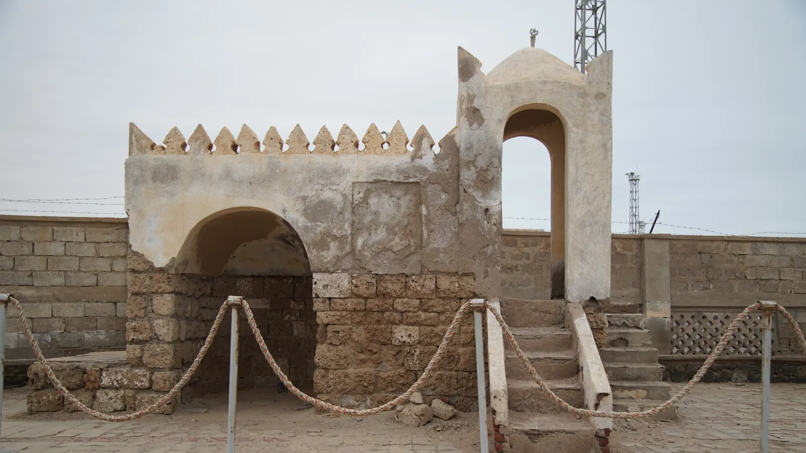
 Mheidegger · CC BY 4.0
Itinerary · Africa · 12 days · Moderate
The Plateau and the Red Sea
Asmara→Nefasit→Keren→Adi Keyh→Qohaito→Metera+3 stops
A country you travel on a paper permit: three days in the modernist city UNESCO listed in 2017, the 950 mm railway east to Nefasit, north to Keren and the gorge the East African campaign turned on, south to an Aksumite plateau at 2,700 metres, then down the escarpment to a coral-block port that has not been repaired since 1990 - and back up the long way through the green belt.
Asmara
Day 1–2 · 2 daysAsmara, and the paperwork
The first working morning goes to the Ministry of Tourism, because nothing outside the city happens without a travel permit and it names the places you may go. Apply for everything on day one - Massawa, Keren, Dekemhare, Adi Keyh, Qohaito, Senafe, the Dahlak islands and the Filfil road - and accept that some of it may come back refused. Then walk Harnet Avenue, which is where Asmara conducts its evenings: palms down the middle, the Catholic cathedral of 1923 at one end, and a coffee culture inherited from the Italians and made thoroughly Eritrean in the eighty-five years since they left. You are at 2,325 metres. Do very little else today.
The modernist city on foot
Everything is within an hour's walk. The Fiat Tagliero of 1938 is a petrol station shaped like an aircraft, its two concrete wings cantilevered about fifteen metres out with no columns beneath them - the story in Asmara is that the builder wanted props and the architect made him take them off, and it is told as a story rather than sworn to. Cinema Impero of 1937 still runs films behind a façade of three rows of round lights. Add the Opera House, the Great Mosque of 1938, the Nda Mariam Orthodox cathedral and the Central Post Office. Finish at Medeber, the recycling market in an old caravanserai, where scrap oil drums are beaten into stoves and buckets and lorry tyres are cut into sandals. Photograph the buildings freely; do not photograph the ministries between them.
East on the railway to Nefasit
The line from Massawa reached Asmara in 1911 on 950 mm gauge, was pulled up during the independence war for the metal, and was relaid from 1994 by retired Eritrean railwaymen and conscripts using recovered rail and the original Italian stock. There is no scheduled passenger service. What exists is a charter - booked weeks ahead through an operator, priced for the train rather than the seat, and worth splitting across a group. It grinds east through tunnels and around the head of the escarpment in a couple of hours for twenty-five kilometres, which tells you most of what you need to know about the gradient. Ask how far it is actually running before you pay: maintenance has not kept up with the rebuild, and in recent years the charters have often turned round at Arbaroba, short of Nefasit. Above the village is Debre Bizen, a monastery founded in 1361 at about 2,400 metres, two to three hours up on foot. Women are not admitted, and neither are female animals; this is a rule of the house and not a thing to argue with at the gate.
Keren
Day 4–5 · 2 daysNorth-west to Keren
Ninety-one kilometres and about two hours, off the plateau and down into a bowl of hills at 1,390 metres. Keren is the market town for the Bilen, Tigre and Tigrinya country around it, and the market is worth building the drive around: the livestock and camel market on the edge of town is a Monday, and it is finished by the middle of the morning, so arriving on a Sunday night is the whole trick. Confirm it in Asmara before you commit the permit dates to it. Coffee roasted and ground in front of you, tea with ginger, and a town that feels nothing like the capital.
The gorge, the cemeteries and the baobab
The Dongolaas gorge above the town is the reason anyone outside Eritrea has heard of Keren. From 5 February to 1 April 1941 Indian, British and Free French forces fought Italian and Eritrean troops for the ridges either side of it, and when the position finally fell Asmara surrendered the same day, Massawa a week later, and the Italian viceroy gave himself up at Amba Alagi on 19 May; the last garrison, at Gondar, held out until November. The Commonwealth cemetery below the town holds several hundred graves and is kept immaculately; there is an Italian cemetery too, and the Eritrean askari who did most of the dying on that side have neither. Afterwards, St Mariam Dearit - a shrine to the Virgin set inside a hollow baobab, and a pilgrimage site every May.
South through Dekemhare to Adi Keyh
A long day of driving that crosses the whole plateau: back to Asmara in two hours, then south-east through Dekemhare, an Italian industrial town of the 1930s that has been slowly emptying ever since, and on along the spine of the highlands to Adi Keyh. The country up here is terraced, stone-walled, thin-soiled and worked hard, and the churches are Orthodox rather than the Catholic and Lutheran mix you have been seeing in the capital. About a hundred and ninety kilometres in total and five hours with the stops.
Qohaito and the Adi Alauti canyon
A plateau at about 2,700 metres a short drive above the town, and the site of a city that sat on the caravan road between the Aksumite highlands and the Red Sea. What is above ground is the standing columns of the so-called Temple of Mariam Wakiro, cut-stone tombs, and the water systems that made a settlement possible on a treeless shelf. Nothing is signed and nothing is fenced, and you need a local guide to find any of it. Below the eastern edge the Adi Alauti canyon holds painted rock shelters - cattle, herders, hunting scenes - that are older than the city on the plateau above by a long way.
Senafe and the stele at Metera
Forty-five minutes south, under the flat-topped bulk of Amba Metera. The archaeological site at Metera is a couple of kilometres beyond the town: the ruins of a settlement occupied from before the Aksumite period, and a granite stele about five metres high carrying a Ge'ez inscription and a disc-and-crescent cut near the top - the same symbol you will have seen on Aksumite coinage. Senafe was occupied and heavily damaged during the 1998–2000 war and has not entirely come back from it. Be clear about where this day puts you: the town is around twenty kilometres from a border that has no open crossing, was never demarcated on the ground, is garrisoned on both sides and still holds mines and unexploded ordnance in places. Several foreign ministries, the British among them, advise against all but essential travel within twenty-five kilometres of it, which takes in Senafe and Metera both, and relations with Ethiopia have not recovered since the Tigray war. This is also the day most likely to have been struck off your permit, and that refusal is the same assessment in another form; if it comes back refused, spend the day on the Qohaito escarpment instead and do not improvise a detour.
Massawa
Day 9–10 · 2 daysDown the escarpment to Massawa
North back up the highland road, then east over the lip and down. In eighty-odd kilometres the road loses 2,300 metres through Nefasit and Ghinda, and the vegetation changes about four times on the way - juniper, then euphorbia and acacia, then nothing. Somewhere on this alignment ran the Asmara–Massawa ropeway, completed in 1937 and a little over seventy kilometres long, the longest in the world when it was built and rated to move around thirty tonnes an hour in each direction; the British administration dismantled it in the 1940s and shipped the material out, and the concrete pylons are still standing in the scrub. Two hundred kilometres in total, five hours, and by the end of it you are at sea level in air that is thirty degrees warmer than the air you started in.
The old town on the islands
Massawa proper is two islands joined to the mainland by causeways, built in coral block and lime with Ottoman, Egyptian and Indian Ocean details - carved wooden balconies, deep arcades, doorways that survived what the buildings behind them did not. The Imperial Palace on Taulud is a shell. The Sheikh Hanafi mosque still functions. The damage is from February 1990, when the EPLF took the port in a three-day assault and the Ethiopian air force bombed it afterwards, and the reason it is still visible thirty-six years on is that there has never been money to do anything about it. Walk it early or late; the middle of the day here is not for walking. The port itself, the causeways and anything in uniform are not to be photographed under any circumstances.
Out to the Dahlak islands
The archipelago is two large islands and something over a hundred small ones, flat, barren and coral, of which a handful are inhabited. The boat is a charter, there is no timetable, and how far you get depends on the hull, the wind and what the marine permit actually says - Dahlak Kebir, the largest island, is fifty-odd kilometres out and around three hours in a local boat, so it is a long day and a better overnight. On it are the rock-cut rainwater cisterns that let a medieval trading settlement exist without a spring, and a burial ground of Kufic-inscribed headstones from the tenth to twelfth centuries, when this was a port on the Red Sea trade. If the boat cannot make it, the nearer islands are shallow, empty and full of fish, and that is a perfectly good day too.
Up through the green belt
The long way home, and it has to be named on the permit before you leave Asmara. North along the coastal plain, then west and up the escarpment through Filfil, where the moisture coming off the Red Sea catches on the slope and holds a strip of semi-tropical forest with nothing like it for hundreds of kilometres in any direction. It is the wettest ground in the country and the birding is the reason most foreigners drive it. The surface is mixed and slow, the drop-offs are unguarded, and after rain the whole thing is a bad idea. About a hundred and seventy kilometres and six hours back into Asmara, which is where the flight out goes from, almost always in the middle of the night.
Good to know
You arrive and leave by air, full stop. The Ethiopian land border has been shut since 2019 - the crossings opened for a few months after the 2018 peace agreement and were closed again inside the year, and nothing since the Tigray war has reopened them - the Sudanese border is closed, and the Djibouti crossing is not a route for visitors - everything comes through Asmara International, on a short list of carriers that changes, so book the flight before you build the trip around it. A visa must be arranged in advance at an Eritrean embassy or consulate; there is no tourist visa on arrival, applications generally want a hotel booking or a letter from a licensed local operator behind them, and processing runs to weeks rather than days. Then the thing that actually governs this route: a travel permit, issued by the Ministry of Tourism in Asmara, is required for any movement outside the capital. It is free or nominal, usually comes back within a day, names your destinations and dates and often the vehicle, and is checked at the barrier on every road out of the city. Massawa, Keren, Dekemhare, Adi Keyh and Qohaito are routinely granted; Senafe and Metera sit close to the Ethiopian border and are refused about as often as not; the Dahlak islands need a separate marine permit; Nakfa, Assab and most of the western lowlands are effectively closed. Apply for the lot on your first morning, list the Filfil road explicitly because it is not the obvious way back, and have a plan for a refusal - driving somewhere your permit does not name is the single fastest way to turn a holiday into a problem. Underneath the permit system sits the reason for it, and it is worth stating rather than inferring: several foreign ministries advise against all but essential travel within twenty-five kilometres of the Ethiopian and Sudanese borders and in the Southern Red Sea region towards Assab - undemarcated frontiers, troops on both sides, and mines and unexploded ordnance left by two wars. Senafe and Metera fall inside the Ethiopian band, which is why they are on this route with that said out loud and why the permit for them is refused as often as it is granted; Nakfa, Assab and the western border country are not on it at all. Photography is the second hard rule and it is not decorative: no military, no police, no checkpoints, no government buildings, no presidential palace, no airport, no bridges or dams, and nothing at all at the port or on the causeways at Massawa. Cameras get taken and people get held. That a building is a World Heritage Site does not extend to the ministry next door to it, and asking before you photograph a person is the norm rather than a courtesy. Money works differently here too. The nakfa is a closed currency pegged at fifteen to the US dollar, you cannot obtain it outside the country and you cannot take it out; you declare your foreign cash on arrival on a form you must keep, and you may be asked to reconcile it on the way out. Change only at Himbol, the state bureau, at the official rate - there is no legal alternative and looking for one is somebody else's risk as well as yours. Foreign cards and ATMs do not work anywhere in Eritrea, so bring the entire trip in US dollars cash, clean and undamaged, with a margin. Fuel is rationed and intermittently short, which is why a hired car with driver is the normal arrangement and why a large unplanned detour may simply not be available on the day; buses run Asmara–Keren and Asmara–Massawa cheaply and are perfectly legal with a permit, but they will not get you to Qohaito. So, plainly: can this be done independently? Legally, yes - Eritrea imposes no minder and no compulsory guide, and the permit is issued to you rather than to an agency, so buses plus permits will get you Asmara, Keren, Massawa and Dekemhare on your own. Practically, everything on this route that is not on a bus route - Qohaito, Metera, Filfil, the railway, the Dahlak boat - needs a vehicle, a charter or both, which is why most people who complete something like this go through an Asmara operator and treat the independent version as the shorter one. Health: a yellow fever certificate is required if you are arriving from or transiting a country with a risk of transmission, which covers most plausible African connections, so carry it. Malaria is absent from Asmara at 2,325 metres and real on the coastal plain, at Massawa, around Keren in the wet months and across the western lowlands - take prophylaxis for the lowland half of this route. Medical facilities are limited and evacuation insurance that genuinely covers Eritrea is worth reading rather than assuming. Season is November to March and it is not a preference: Massawa regularly passes 40°C between June and September and the coast is among the hottest inhabited places on earth, while the highland rains from about June to September make the Filfil road and the track up to Qohaito slow or impassable. Internet is slow, expensive and heavily limited, mobile data barely exists and international roaming largely does not work, so tell people at home to expect silence. If you were born in Eritrea or hold Eritrean citizenship alongside another, none of the above is the main question for you: dual nationals have been treated as nationals on arrival, national-service liability included, and a second passport has not reliably prevented it - take advice from your own foreign ministry before booking, not after. Last, and it matters more than any of the above: indefinite national service is the central fact of most Eritrean lives and it is not a subject to raise with people in a bar or a taxi. The consequences of that conversation fall on them, not on you.
Shorter or longer?
Add three days and turn the boat day into a stay. Sleeping on Dahlak Kebir means the cisterns and the Kufic burial ground in the early morning rather than in the middle of a day trip, and the outer islands become reachable. It needs the marine permit to cover the overnight, a boat and crew chartered for the block rather than the day, and everything you will eat and drink carried out with you.
Asmara, the railway to Nefasit, Keren, then down the escarpment to Massawa and the near islands, and back up the same road. Keeps the architecture, the 1941 battlefield and the Red Sea; cuts the whole southern leg - which is also the part of the permit most likely to be refused, and the two longest driving days.
Practical guide
Visa check for this route
Budget
Mid-range · per person · sharing a double room. Excludes international flights - they depend on where you fly from.
Editorial estimates · checked August 2026
Country guides
Trip essentials
The connectivity placement is our own eSIM store. No affiliate link on this list. How we choose these →