Itinerary · Asia · 13 days · Challenging
Punjab and the Karakoram
Lahore→Lahore Museum→Taxila→Skardu→Shigar→Khaplu+7 stops
Advisory - travel not recommended · checked 26 Sept 2026
Pakistan
Foreign ministries advise against travel to Balochistan, Khyber Pakhtunkhwa and the areas near the Afghan and Indian borders. The rest of the country - Islamabad, Lahore, the Karakoram Highway in season - is visited routinely, so read the regional detail rather than the headline.
Official advisory →Every advisory in force →Read the advisory first, and read it by region: foreign ministries advise against travel to Balochistan, to Khyber Pakhtunkhwa and to the strips along the Afghan and Indian borders, and this route enters none of them. What it does is the part of Pakistan that is visited routinely - Lahore and Taxila in Punjab, then Baltistan and the Karakoram Highway north to the Chinese border, all of it inside Gilgit-Baltistan. The route is published for people who have read the regional detail rather than the headline, and it is not an argument that the country is uniformly open.
Lahore
Land in the morning if you can and spend the afternoon inside the walled city. The Wazir Khan mosque of 1634–41 is the reason to walk in rather than drive: it sits at the end of a lane of shops, is faced almost entirely in kashi-kari tilework, and has been under a long conservation programme run with the Aga Khan Trust for Culture that has also reopened the Shahi Guzargah, the processional route from Delhi Gate. Come out at the far end for the Badshahi mosque of 1673 and the Lahore Fort opposite it. The Wagah flag ceremony is not on this route: it sits inside the strip along the Indian frontier that the advisories cover.
Lahore Museum and the Shalimar gardens
The museum on the Mall holds the Gandhara collection, and the object people come for is the Fasting Buddha from Sikri - second or third century, ribs and tendons rendered by a workshop that had absorbed Hellenistic anatomy a very long way from Greece. Rudyard Kipling's father was curator here, which is why the building opens Kim. Then the Shalimar gardens, laid out in 1641 on three descending terraces with several hundred fountains, and an evening at a rooftop table facing the Badshahi mosque, which is what Lahore does instead of a nightlife.
Taxila and Islamabad
North on the M-2, a tolled motorway opened in 1997 that runs 367 km (228 mi) to Islamabad and is one of the easiest roads in South Asia. Break it at Taxila, where three separate cities were built and abandoned between roughly the sixth century BC and the fifth century AD: Bhir Mound, Sirkap on a grid the Indo-Greeks laid out, and Sirsukh. The Dharmarajika stupa and the monastery at Jaulian are the two to walk if time is short. Taxila sits 35 km (22 mi) past Islamabad rather than short of it, so the day ends by doubling back. Islamabad in the evening is a planned capital from 1960 with the Margalla hills behind it, and it is where the mountain logistics get confirmed.
Flight to Skardu
An hour up the Indus by air, over the western end of the Himalaya, into a valley floor at about 2,230 m (7,320 ft) with sand dunes on it. Skardu is the staging town for the Baltoro glacier and everything beyond it, and the afternoon is enough for Kharpocho fort above the town and the Manthal Buddha rock on the far side, a standing Maitreya carved into granite somewhere around the eighth century, from the period before Baltistan became Muslim. Build a spare day into the trip for this flight: it is weather-cancelled often.
The Shigar valley
An hour north-east over a low pass into the valley that leads to the Baltoro. Shigar Fort was built by the Amacha rajas in the seventeenth century, was a ruin by the 1990s, and was rebuilt over six years by the Aga Khan Trust for Culture using Balti carpenters and the original timber joinery; it reopened in 2005 as a hotel with a museum inside it, which is how the restoration pays for its own maintenance. Walk up to Khilingrong mosque, a wooden Kashmiri-style building of the same period, then out onto the Sarfaranga cold desert, which is river sand at 2,200 m (7,200 ft).
East to Khaplu
Back down to Skardu and then east along the Shyok, three hours on a road that has been widened but still has the drops. Khaplu was the seat of the Yabgo dynasty and its palace, finished around 1840, is the best-preserved raja's residence in Baltistan - again an Aga Khan Trust restoration, completed in 2011, again run as a hotel to keep it standing. Chaqchan mosque below it is dated to the late fourteenth century and attributed to the missionary Mir Sayyid Ali Hamadani; it is wood, it is still in use, and it looks nothing like a mosque anywhere west of here.
Back to Skardu
The return drive with the light on the other side of the valley, and an afternoon that is deliberately light because tomorrow is not. Upper Kachura lake sits in a bowl of poplars twenty minutes from town; Sadpara, above Skardu, was dammed in the 2010s and the reservoir drowned a good part of the old village and a rock carving site with it, which is worth knowing before you photograph the water. Confirm the Deosai crossing tonight - the road over is a summer road and the answer changes week to week.
Across Deosai
The plateau is a national park of about 3,000 sq km (1,160 sq mi) sitting above 4,000 m (13,100 ft), snow-covered from roughly October to late June and grassland with flowers on it for the weeks in between. It was gazetted in 1993 largely to protect the Himalayan brown bear, whose numbers here had fallen to around twenty animals by the early 1990s and have since recovered to somewhere between fifty and eighty, depending on which survey you read. Sheosar Lake is the stop, at around 4,140 m (13,580 ft). The crossing to Astore takes most of a day in a 4WD and there is no fuel, no phone signal and no shelter on it.
Down to Gilgit
The Astore valley drops to the Indus above Bunji and joins the Karakoram Highway across the river at Jaglot. The viewpoint at the confluence is signposted as the junction of three ranges - Himalaya to the south, Karakoram to the north-east, Hindu Kush to the west - and it is the one place where the geography of the whole route is legible at once. North to Gilgit for the afternoon: the bazaar, the Kargah Buddha carved into a cliff face west of town, and the small Chinese cemetery holding workers who died building the road you are about to drive.
Up the Hunza valley
A hundred kilometres (62 mi) of the Karakoram Highway north, climbing beside the Hunza river with Rakaposhi at 7,788 m (25,551 ft) standing directly over the road near Ghulmet - one of the largest unbroken rises from base to summit anywhere. Stop at the Rakaposhi viewpoint, then at Hassanabad, where the bridge was destroyed on 7 May 2022 by a flood off the surging Shisper glacier. Karimabad is terraced apricot and cherry orchards on the valley's south-facing side, and it is the base for the next two days.
Baltit, Altit and Duikar
Altit fort is the older of the two, with a tower dated by timber to around the eleventh century, making it among the oldest surviving buildings in the region; Baltit above it was the seat of the Mirs of Hunza until 1945 and was abandoned in the 1950s. Both were restored by the Aga Khan programme and Baltit opened as a museum in 1996. The Royal Garden below Altit was replanted with the fruit varieties that were being lost. Go up to Duikar for the evening, at about 2,900 m (9,500 ft), where the valley opens out under Ultar Sar.
Attabad, Gulmit and Passu
Twenty minutes north the road enters the first of the tunnels and comes out above a lake that did not exist in 2009. Attabad is the subject of this country's feature and it is worth the boat trip rather than only the viewpoint. Beyond it, Gulmit is the old capital of Gojal, part of it under the water; Passu has the cathedral spires of Tupopdan at 6,106 m (20,033 ft) above it, the Passu glacier snout twenty minutes off the road, and a suspension bridge of wire and planks over the Hunza that people cross to get to their fields and visitors cross for the fright.
Khunjerab and down
Sost is the last settlement and the customs post; above it the road runs through Khunjerab National Park, where Marco Polo sheep and ibex are protected and are occasionally on the tarmac. The pass at 4,693 m (15,397 ft) is the highest paved border crossing on earth, and the line on the ground is a gate, a marker and, usually, a great deal of wind. You cannot cross without a Chinese visa and the formalities are done at Sost and Tashkurgan, not at the top. Then the long descent to Gilgit for the flight out the following morning.
Good to know
Start with the advisory and read it province by province, because Pakistan is the case where the headline and the map disagree. Foreign ministries advise against all travel to Balochistan, to the Khyber Pakhtunkhwa districts along the Afghan frontier and to the immediate Indian border strip, and against all but essential travel to much of the rest of Khyber Pakhtunkhwa including Peshawar, Swat and Chitral. This route goes to none of those. Punjab, Islamabad and Gilgit-Baltistan carry ordinary advice and are visited routinely. Check your own ministry the week you travel - it is what your insurer follows.
Insurance is the line people get wrong. A standard policy will usually cover Punjab, Islamabad and Gilgit-Baltistan, and will usually void itself the moment you enter a region under an against-all-travel notice, which is one reason this route stays out of them. Separately, most ordinary policies exclude altitude above 3,000 or 4,000 m and exclude helicopter retrieval, and this route crosses Deosai and stands at 4,693 m. Buy a policy that names an altitude ceiling above 5,000 m and includes mountain search and rescue; expect roughly €200–300 for thirteen days, and read the region exclusions rather than the marketing.
Visas are online. The NADRA e-visa system has run since 2019 and issues tourist visas to well over a hundred nationalities; the application wants a hotel booking or an invitation letter from a registered Pakistani tour operator, and using an operator is the faster of the two. Print everything. There is no general foreigner registration requirement, but police checkposts on the Karakoram Highway record passport details repeatedly, and the way to make that painless is to carry twenty photocopies of the data page and the visa and hand one over each time.
A No Objection Certificate is required for restricted zones and for treks near the Chinese and Indian frontiers, and it is obtained in advance through an operator, not on the day. Nothing on this route needs one. Foreigners are sometimes assigned a police escort on stretches of the KKH through Diamer and Kohistan and occasionally in Punjab; it is not optional when it is offered, it is free, and it is a good reason not to plan tight connections.
Money is cash. The rupee has depreciated heavily and prices in older sources are meaningless. ATMs in Lahore, Islamabad, Gilgit and Skardu take foreign cards with fees, and several will decline a given card for no stated reason, so carry more than one. North of Gilgit, machines are scarce and run empty; draw what you need before you go up the valley. Cards work at good hotels in the cities and essentially nowhere in Gojal.
Season decides half of this route. Deosai is open roughly from late June to early October and the Khunjerab Pass is officially seasonal on the same rough calendar, though the gate hours and the year-round question have both moved in recent years - confirm both a fortnight out. Hunza's blossom weeks in April are the most photographed in the country and Deosai is under snow then, so the two do not combine. July and August bring the monsoon to the plains and leave the north dry.
Do not drive yourself on the Karakoram Highway. Hire a driver who works it - landslides, unlit tunnels, single-lane sections and no barrier - and do not move between towns after dark. A local SIM needs your passport and a franchise visit; mobile data has been suspended nationally during political unrest more than once, so do not build a plan that depends on being reachable. Do not photograph checkpoints, bridges or anything military anywhere in the country.
The flights are the weak link. Islamabad–Skardu and Gilgit–Islamabad are morning services flown on sight rules through valleys and they cancel for weather with no notice; the road alternative from Islamabad is two days up the KKH through Kohistan, which sits under a different advisory grade than Gilgit-Baltistan does. Carry two spare days and decide in advance which way you would rather lose them.
Shorter or longer?
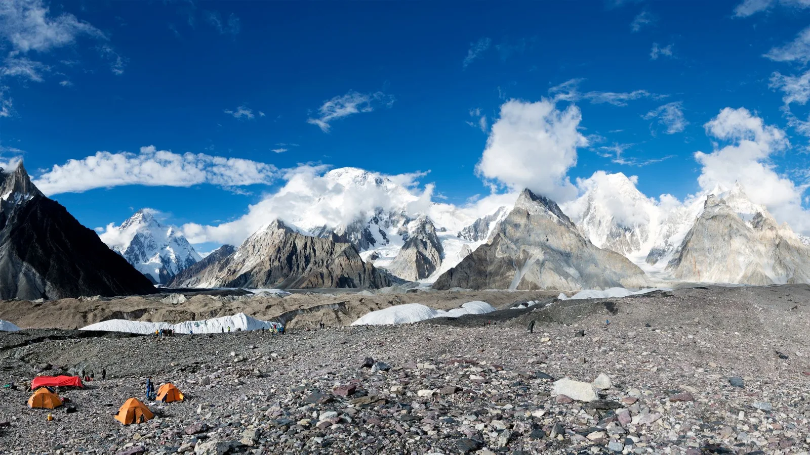
Add about fourteen days from Skardu: jeep to Askole, then the Baltoro glacier to Concordia, where four peaks above 8,000 m stand within sight of one camp. It is done through a licensed Pakistani operator with porters and a government-registered guide, which is the only legal way to walk it. Unlike anything on the main route, the Baltoro is a restricted zone and needs a No Objection Certificate arranged weeks ahead, and K2 base camp at about 5,150 m (16,900 ft) sits above the 5,000 m insurance ceiling this route budgets for. It is a genuine high-altitude expedition rather than a long trek.
Fly Islamabad–Gilgit and give the whole trip to the upper valley: Karimabad and the two forts, Attabad and the tunnels, Passu, Sost and the Khunjerab Pass. Drops Lahore, Taxila, Baltistan and Deosai, and removes every long transfer except the one at each end.
Practical guide
Visa check for this route
Budget
Mid-range · per person · sharing a double room. Excludes international flights - they depend on where you fly from.
Editorial estimates · checked August 2026
Country guides
Trip essentials
The connectivity placement is our own eSIM store. No affiliate link on this list. How we choose these →