 Tappiah Sesay · Pexels License
Itinerary · Africa · 12 days · Moderate
The Peninsula and the East
Freetown→Bunce Island→Tacugama, Regent→River No. 2 Beach→Dublin, Banana Islands→Bo+6 stops
Freetown, the forested peninsula behind it and the island castle in the estuary that shipped rice farmers to South Carolina - then east on the one good highway in the country to an island of rainforest in the Moa river with eleven primate species on it, the diamond town beyond, and a dam in the northern hills that took thirty-four years and a civil war to finish.
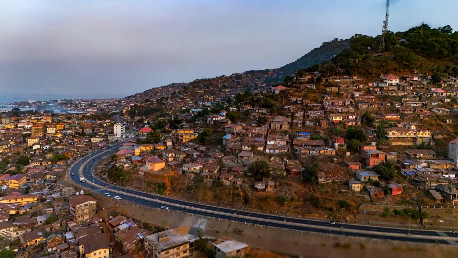
Freetown
Lungi airport is on the wrong side of the estuary from the city it serves, so the first decision of the trip is how to cross: a water taxi from the terminal jetty over to Aberdeen in about forty minutes, the government ferry for a fraction of the price and rather more than an hour, or the road round through Port Loko, which is 130 kilometres and most of an afternoon. Take a boat. Then give the day to the centre. The Cotton Tree - the tree the Nova Scotian settlers are said to have gathered under in 1792, and the thing on the banknotes - came down in a storm on 24 May 2023, and the empty ground where it stood is worth ten minutes of standing in. The National Museum is beside it. The Sierra Leone Peace Museum, out at the site of the Special Court in New England Ville, is the harder and better of the two.
Bunce Island
Charter a boat and go up the Sierra Leone River - about two hours each way, tide dependent, and it must be arranged the day before. Bunce Island was a British slaving station from around the 1670s until Britain abolished the trade in 1807, and its specialism was the point: the traders here sold people from the rice-growing country inland, and the planters of South Carolina and Georgia paid a premium for them because they already knew how to grow rice in tidal swamp. From 1748 the owners were Grant, Oswald & Company of London; Richard Oswald, a partner, went on to negotiate the treaty that ended the American War of Independence, and his Charleston agent was Henry Laurens. The ruins are roofless, unrestored and unfenced, and Gullah families from the Carolina Low Country have been coming here since the 1980s. Back in Freetown by mid-afternoon.
Tacugama, then down to the coast
Forty minutes up into the peninsula forest to the chimpanzee sanctuary above Regent. Tours run at fixed times and must be booked in advance - turning up unannounced does not work. Something over a hundred western chimpanzees live here, almost all of them confiscated from the pet or bushmeat trade, and the sanctuary is the only place in the country the state can legally put one. There is no road over the ridge to the beaches, whatever a map suggests: you come back down the same way, cross the city to Lumley and take the coastal peninsula road south, which is a slow thirty kilometres of headlands and switchbacks with the Atlantic appearing and disappearing below you. Budget for Freetown traffic in the middle of that.
River No. 2 and the peninsula forest
A river comes out of the forest across white sand into the sea, and the beach around it has been run since the early 1990s by an association of the village that lives there - boats, food, huts and fees, with the money staying local. That arrangement is the interesting thing here, because almost every other beach on this coast has been sold or leased to somebody else. Take a canoe up the lagoon, walk to the waterfall behind it, and look up at Sugar Loaf standing over the whole peninsula. The forest on it is a national park and also Freetown's watershed, which is the argument that actually protects it.
Banana Islands
South to Kent at the tip of the peninsula, then a fishing boat across to Dublin - thirty to forty-five minutes depending on the swell, and the crossing is genuinely rough in the rains. Three islands, two villages, a few hundred people, no vehicles. The ruined stone church at Dublin dates from the 1880s, there are iron cannon lying in the undergrowth from the anti-slavery patrol station that operated here after 1808, and the snorkelling off Ricketts is the best on this coast. Stay the night on the island rather than day-tripping it: the boat back in the late afternoon is the worst part of the day.
East to Bo
The long transfer, and the one day of the trip that is mostly windscreen. Back up the peninsula, through Waterloo, and out onto the highway east - Masiaka, Mile 91, Moyamba Junction, Bo. About 270 kilometres and five to six hours, on tarmac the whole way and the fastest driving of the trip; from Bo eastward and northward the surface gets steadily worse. Bo is the second city and the old capital of the Protectorate; Bo School, founded in 1906 to educate the sons of chiefs, is still going, and the market is the largest thing east of Freetown.
Bo to Tiwai Island
South-east to Potoru on progressively worse road, then the last stretch of laterite to the landing at Kambama and a dugout across the Moa. Three to four hours in the dry season and considerably more after rain. Tiwai is twelve square kilometres of river island that has been a research site since the early 1980s and a wildlife sanctuary since the late ones; it was abandoned during the war and reopened in 2002, and it is run jointly by an environmental foundation and a committee of the villages on both banks. Accommodation is tents on platforms and a shared kitchen. There is no electricity beyond a solar panel.
Tiwai
Out at six with a guide from one of the villages. Eleven primate species have been recorded on the island, which is an unusually high count for a piece of forest this size - Diana monkey, king colobus, sooty mangabey, olive colobus, and chimpanzees that are heard far more often than seen. Pygmy hippo live here and are almost never seen at all; the camera traps get them, visitors essentially do not, and anyone promising otherwise is selling something. Do the night walk for the galagos and the dawn boat along the channel, which is the best hour of the day.
North to Kenema
Off the island and up through Joru to Kenema - about 110 kilometres, laterite for most of it, three and a half hours. Kenema is the Eastern Province capital and it runs on two things it is trying to stop running on: diamonds, dealt out of the small offices along Hangha Road, and timber. The Kambui Hills reserve rises straight out of the back of town. It is also the administrative base for Gola Rainforest National Park, gazetted in 2011 on the Liberian border as half of a transboundary peace park - the largest surviving block of Upper Guinean rainforest in the country, and a two-day commitment on roads that this route does not have time for.
Across to Makeni
West to Bo on good tarmac, then north through Mile 91 and Magburaka into the Northern Province - around 220 kilometres and the best part of five hours, with a long stretch of decent road in the middle. Makeni is a Temne city, the home town of Ernest Bai Koroma, president from 2007 to 2018, and it shows in the tarmac. It grew fast after the war and faster during the iron ore boom, when African Minerals ran the Tonkolili operation out of here and the town filled with contractors. The company went into administration in 2015, the Chinese buyer restarted the mine with a fraction of the payroll, and Makeni went back to trading for the Bombali farmland around it. Wusum Hill behind the town, in the last hour of light, is where you can see how much of that farmland there is.
Bumbuna
Seventy kilometres north into the hills on a mix of tar and laterite, about an hour and three quarters each way. The dam on the Seli was begun in 1975, stopped when the money ran out, restarted, and stopped again in 1997 when the fighting reached the site and the Italian contractors left. It was finally commissioned in 2009 - thirty-four years, and for most of that time the half-built structure sat in the hills as the single largest thing the country had abandoned. Its 50 megawatts remain a large share of Sierra Leone's grid, and in the dry season, when the reservoir drops, so does the power in Freetown. Ask at the gate before walking anywhere near the works.
Back to Freetown
South-west on the highway through Masiaka - 180 kilometres, three and a half hours, and the traffic thickens from Waterloo onwards until the last ten kilometres take as long as the first hundred. Leave far more time than the distance suggests if you are flying out, and remember that the airport is still on the far side of the water: the last water taxi is early evening, and missing it means the ferry or a night on the Lungi side.
Good to know
Most nationalities need a visa and it is easiest to get online before you fly - Sierra Leone has run an electronic visa system since 2019, a single-entry tourist visa costs in the region of US$80, and you should carry the printed approval rather than trusting a phone at the desk. ECOWAS citizens do not need one. A yellow fever certificate is required of every arrival over nine months old and it is actually checked at Lungi, so bring the card; since 2016 it is valid for life and no country may demand a booster. Malaria is the serious medical question here - falciparum, year-round, everywhere in the country including central Freetown - and there is no altitude anywhere on this route to escape it, so take prophylaxis for the whole twelve days and use a net. Check current health advice close to departure: Sierra Leone declared a public-health emergency over an mpox outbreak in 2025, and airport health screening has been routine since the Ebola epidemic of 2014–16, which the country was first declared free of on 7 November 2015 and then, after a flare-up of new cases, again in March 2016. The rains run roughly May to November and peak in July and August, and Freetown is one of the wettest capitals in West Africa - well over 3,000 millimetres a year, most of it in four months. This route is a December-to-April proposition. In the rains the laterite to Potoru, Tiwai and Bumbuna turns to a surface that strands 4×4s, the Moa runs high and fast, and the open boat to the Banana Islands is genuinely unpleasant. December and January bring the harmattan instead: cooler nights, and a dust haze that flattens every view and occasionally delays flights. Self-drive is not realistic and almost nobody offers it - hire a vehicle with a driver, which runs somewhere around US$100 to US$150 a day including fuel and is the largest single line in the budget. The Freetown–Bo–Kenema highway is tarred and in reasonable condition; everything off it is laterite, and a saloon car will not get you to Tiwai. Police and military checkpoints are frequent and routine: slow down, greet, hand over the licence, expect no trouble. Do not drive after dark outside towns - unlit vehicles, no verges, and pedestrians on the carriageway. The leone was redenominated on 1 July 2022 with three zeros knocked off and a new code, SLE, and people still quote prices in old leones out of habit, so confirm which you are being told before agreeing to anything. This is a cash economy: ATMs work in Freetown, Bo, Kenema and Makeni and nowhere useful in between, cards are accepted in perhaps a dozen places in the country, and Orange Money is how most transactions actually settle. Book Tacugama and the Bunce Island boat several days ahead, and Tiwai at least a week ahead in season - the station is small and fills. Photographing the airport, bridges, government buildings, police and soldiers causes trouble; ask before photographing anyone at all, which is expected here and generally answered warmly.
Shorter or longer?
Add five or six days from Makeni: north to Kabala, then out to the village of Sinekoro to arrange porters and the chief's permission, and three to four days on the mountain. Mount Bintumani is 1,945 metres and the highest point in West Africa west of Cameroon. It is a hard walk rather than a climb, there is no infrastructure of any kind, and it is only feasible in the dry season.
Freetown, Bunce Island, Tacugama, the west-coast beaches and two nights on the Banana Islands, then home. Keeps the estuary, the forest and the coast; cuts the whole eastern leg, the long transfer days and roughly two-thirds of the vehicle cost, which is where the money on this trip goes.
Practical guide
Visa check for this route
Budget
Mid-range · per person · sharing a double room. Excludes international flights - they depend on where you fly from.
Editorial estimates · checked August 2026
Country guides
Trip essentials
The connectivity placement is our own eSIM store. No affiliate link on this list. How we choose these →