Itinerary · Asia · 38 days · Expedition
The Silk Road Overland
Tbilisi→Sheki→Baku→Gobustan→Alat→Caspian Sea+21 stops
Five weeks from the Caucasus across the Caspian to the mosaic cities of Uzbekistan and the high passes of Kyrgyzstan. The classic overland test piece.
Tbilisi
Day 1–2 · 2 daysTbilisi
The route starts where Europe stops being a useful word. Spend the first day on paperwork rather than sightseeing: check your Azerbaijani e-visa is issued, your Uzbek entry conditions still hold, and that you have a plan for Kazakh registration. Then the sulphur baths, because you will not see plumbing like it again for a month.
Tbilisi, and provisioning
The Georgian National Museum for the Colchis goldwork, then the practical afternoon: a Caucasus-compatible SIM, a water filter if you are carrying one, cash in small denominations. Dollars in clean, unmarked notes are the currency that works everywhere east of here, and torn ones are refused.
East to Sheki
Cross into Azerbaijan at Lagodekhi and drop into the foothills of the Greater Caucasus. Sheki's Khan's Palace is covered in shebeke - stained glass held in a wooden lattice assembled without nails or glue - and the eighteenth-century caravanserai in the centre still takes guests, which is a fitting first night on a Silk Road route.
Baku
Day 4–5 · 2 daysDown to Baku
Five hours south-east, out of the mountains and onto the dry Caspian plain. Baku announces itself with three flame-shaped towers on a ridge above a medieval walled city, which is a reasonable summary of the place. Get your bearings on the boulevard and find out where the ferry ticket office actually is.
Icherisheher
The walled city is a UNESCO site and takes a morning at a slow pace: the Maiden Tower, whose purpose nobody has settled, and the Shirvanshahs' palace complex above it. In the afternoon, the Heydar Aliyev Centre - a Zaha Hadid building with no straight lines anywhere, and worth the taxi out.
Gobustan and the mud volcanoes
An hour south, more than six thousand petroglyphs cut into rock over some 40,000 years - boats, hunts, dancers - and a Roman inscription from the first century marking the furthest known Roman presence in the Caucasus. Beyond it, a field of mud volcanoes that bubble cold grey slurry with no warning and no schedule.
Alat, and the waiting
The Caspian ferries are cargo ships that take a few passengers and they do not run to a timetable - they leave when the freight is loaded, which might be tonight or in three days. Move down to Alat port, 70 km (43 mi) south, buy the ticket in person, and keep your phone charged for the call.
The Caspian crossing
Eighteen to thirty hours across to Kazakhstan on a Ro-Ro freighter, in a cabin with a bunk and no guarantee of food beyond what the crew mess can spare. Bring water, bread and something to read. The sea is flat, the horizon is empty, and this is the single leg that makes the route an overland one rather than a tour.
Landfall at Aktau
The ferry docks at Kuryk, an hour and a half south of Aktau. Kazakh immigration is at the port; visa-free entry covers most European and North American passports for thirty days. Aktau is a Soviet planned city with no street names - addresses are microdistrict, block, apartment - built to serve a uranium mine and a nuclear-powered desalination plant.
Into Mangystau: Torysh and Sherkala
Hire a 4×4 with a driver - there is no public transport into this landscape and no fuel once you leave the highway. Torysh is a valley of stone spheres, weathered concretions the size of cars scattered across a plain. Sherkala, further on, is a lone chalk dome that looks like a pitched tent from one side and a lion from another.
Bozjyra
The floor of a sea that dried out, now a chalk canyon of white towers and flat-topped mesas dropping several hundred metres from the rim. There is nothing there - no fence, no ticket, no signal - which is the entire appeal. Camp on the rim if your driver carries the gear, and expect wind all night.
Karagiye, and back to the coast
The Karagiye depression bottoms out at 132 m (433 ft) below sea level, one of the lowest points in the world and visible as a green line at the base of a beige wall. Back to Aktau in the afternoon; underground mosques cut into the cliffs at Shakpak-Ata or Beket-Ata are a worthwhile detour if the day allows.
The train to Beyneu
Kazakh railways run on time and cheaply, and the platskart open carriage is the correct way to travel them: everyone shares tea, and someone will feed you. Aktau to Beyneu takes most of a day across steppe with nothing in it. Beyneu is a rail junction and not a destination.
Nukus
Day 14–15 · 2 daysInto Uzbekistan
The Tazhen crossing south of Beyneu is remote and slow, and the road on the Uzbek side runs through the Ustyurt to Nukus. Uzbekistan is visa-free for most European passports for thirty days and the customs form matters more than the passport - declare cash honestly, in full.
The Savitsky collection
The Nukus Museum of Art holds the second-largest collection of Russian avant-garde painting anywhere, assembled by Igor Savitsky in a desert town precisely because Moscow was not looking. Work that would have been destroyed in the 1930s survived here because nobody thought to check. It is the least likely great museum on earth.
Moynaq and the Aral
Moynaq was a fishing port. The sea is now more than 150 km (93 mi) away, and a dozen rusting trawlers sit on sand where the harbour was - the plainest monument to an engineered catastrophe you will ever stand in. The museum in town shows what the place looked like when the water was still there.
Khiva
Day 17–18 · 2 daysTo Khiva
South along the Amu Darya - a river that no longer reaches the sea it once fed. Khiva's inner walled city, the Itchan Kala, was the first site in Uzbekistan on the UNESCO list. Arrive in the late afternoon and walk the walls at sunset, when the mud brick goes the colour of the desert around it.
Itchan Kala
A single ticket covers everything inside the walls. The Kalta Minor minaret was meant to be the tallest in the Islamic world and stopped at a third of the plan when the khan died, which is why it is a fat turquoise stump. Juma mosque holds 213 carved wooden columns, no two alike, some over a thousand years old.
Bukhara
Day 19–22 · 4 daysAcross the Kyzylkum
Seven hours of red desert between Khiva and Bukhara with the Amu Darya crossed once and almost nothing else. The road is better than it was and the shared taxis still drive it as though it were not. Arrive in Bukhara in the evening and eat by the pool at Lyab-i Hauz.
Poi Kalyan
The Kalyan minaret is 47 m (154 ft) of brickwork from 1127 and Genghis Khan reportedly spared it when he levelled everything else. Beside it the Kalyan mosque holds ten thousand people and the Mir-i-Arab madrasa still teaches. The Ark fortress across the square was the emir's citadel until 1920.
Bukhara's trading domes
The covered bazaars are organised by trade - jewellers, hatters, moneychangers - as they were when the caravans arrived, and two of the three still work as markets rather than souvenir halls. Chor Minor, tucked in the backstreets with four unequal blue towers, is the one building here nobody photographs enough.
The edges of Bukhara
Out of the centre: the Ismail Samani mausoleum from the tenth century, whose brick geometry predates almost everything else standing; Chor Bakr, a necropolis of courtyards on the western edge; and the emir's summer palace, which is what happens when Russian taste arrives with money and no restraint.
Samarkand
Day 23–25 · 3 daysFast train to Samarkand
The Afrosiyob high-speed service covers the distance in under two hours at 230 km/h (143 mph), which is a strange sensation on a route you have otherwise crossed by cargo ship and shared taxi. Book several days ahead; this train sells out. Evening at the Registan when the tour groups have gone.
The Registan
Three madrasas facing a single square across three centuries, and the Sher-Dor has tigers and human-faced suns on its portal in open defiance of the ban on depicting living things. Restoration here has been heavy - much of what you see is twentieth-century Soviet work - and it is still the finest square in Central Asia.
Shah-i-Zinda and Ulugh Beg
Shah-i-Zinda is a narrow lane of tombs tiled floor to ceiling in blue, built over eight centuries and best entered at opening time. Then Gur-e-Amir, where Timur is buried under a slab of dark jade, and the remains of Ulugh Beg's observatory - a sextant cut into bedrock that measured the year to within a minute in the 1420s.
Shakhrisabz
Over the Takhtakaracha pass to Timur's birthplace, where the Ak-Saray palace survives only as two colossal fragments of gateway - which still gives the scale of the thing better than a complete building would. The town centre was heavily redeveloped in 2015 and UNESCO put the site on its danger list because of it.
Tashkent
Day 27–28 · 2 daysTashkent
The capital was flattened by an earthquake in 1966 and rebuilt as a Soviet showpiece, so it reads nothing like the desert cities behind you. Chorsu bazaar under its blue dome is the exception and the best lunch in the country. Plov here is a Wednesday institution taken seriously.
The metro, and the oldest Quran
Tashkent's metro stations were built as bomb shelters and decorated as palaces, and photography in them was banned until 2018. At Khast Imam, the Samarkand Kufic Quran is claimed as one of the oldest in the world, written in the seventh or eighth century and stained, by tradition, with the blood of the caliph Uthman.
Into the Fergana valley
Through the Kamchik pass into the most fertile and most densely populated corner of Central Asia. Kokand was the seat of a khanate until the Russians took it in 1876; the Khudayar Khan palace is what is left, and it is a great deal of tilework for a building that lasted thirteen years.
Silk at Margilan, ceramics at Rishtan
The Yodgorlik factory in Margilan still makes ikat by hand - silk tie-dyed thread by thread before weaving, so the pattern blurs where the colours meet. Rishtan, an hour west, has been firing blue-and-white pottery from local clay for a thousand years and the workshops take visitors without ceremony.
Osh
Day 31–32 · 2 daysAcross to Osh
The Dostyk crossing outside Andijan puts you in Kyrgyzstan in an hour, and the change is immediate - Kyrgyz faces, Russian signage, mountains at the end of every street. Osh claims three thousand years and has the bazaar to support it, running a kilometre along the river.
Sulaiman-Too
The sacred mountain in the middle of the city is Kyrgyzstan's only cultural UNESCO site - a place of pilgrimage since long before Islam, with petroglyphs, worn rock slides said to cure ailments, and a small mosque built by Babur before he went off to found the Mughal empire.
Arslanbob
The largest walnut forest in the world, eleven thousand hectares of it, worked by an Uzbek community that harvests under the trees each autumn. The village sits at 1,600 m (5,250 ft) with two waterfalls above it, and the community-based tourism office places you in family homes rather than hotels.
The road to the jailoo
A long mountain day east through Jalal-Abad and Kazarman on a road that is closed by snow for half the year and unsealed for much of the rest. This is the least comfortable driving on the route and the payoff is what it delivers you to.
Song-Kul
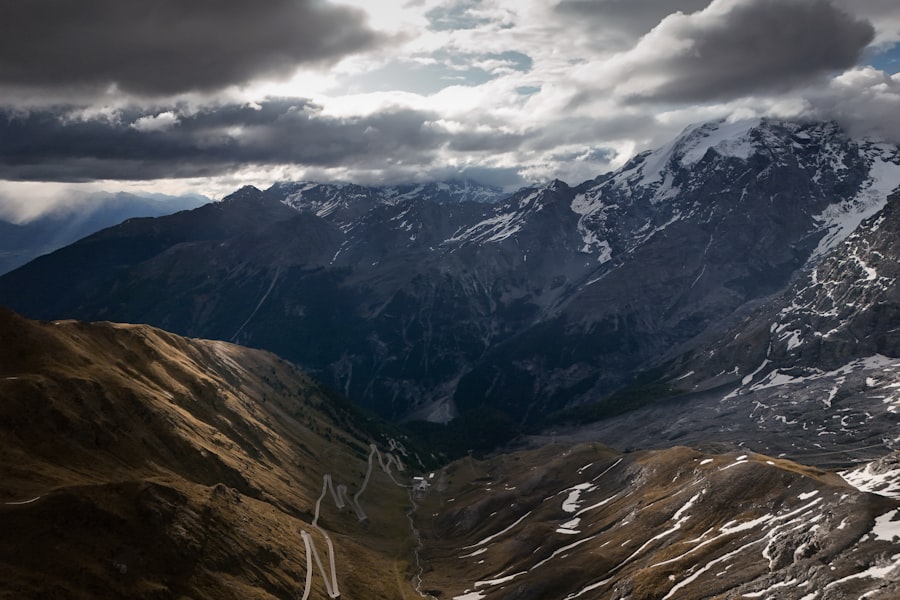
An alpine lake at 3,016 m (9,895 ft) with no permanent settlement on it - only summer pastures, yurts and horses, from June to September. Sleep in a yurt, ride if you can, and understand that the cold at night is real even in August. There is no signal and no electricity beyond a solar panel.
Tash Rabat
Down off the plateau to Naryn, then up a side valley to Tash Rabat - a stone caravanserai from the fifteenth century standing alone at 3,200 m (10,500 ft) on the old route to Kashgar. Thirty-one domed rooms around a central hall, and nothing else within an hour in any direction.
Issyk-Kul's southern shore
North to the second-largest alpine lake in the world, which is slightly saline and never freezes. The southern shore is the quiet one: Skazka canyon of red sandstone above the water, the Barskoon valley behind it, and Karakol at the eastern end with a wooden mosque built by Dungan Muslims without nails.
Bishkek
The last leg runs along the north shore to a capital of Soviet boulevards and mountain views at the end of them. Osh bazaar for what you did not buy earlier, Ala-Too square for the changing of the guard, and a final plate of ashlan-fu - cold Dungan noodles, the correct end to five weeks of rice and mutton.
Good to know
The Caspian ferry is the part that breaks itineraries. It is a freight service that carries passengers as an afterthought, there is no published schedule, and waits of one to four days at Alat are normal. Build slack around it or accept that you will lose it somewhere else.
Entry rules across the five countries are the most changeable thing here. Georgia, Kazakhstan, Uzbekistan and Kyrgyzstan are visa-free for most European and North American passports; Azerbaijan needs an ASAN e-visa; Kazakhstan may require registration if you stay beyond the visa-free window. Check every one of them within a month of departure, not before.
Cash discipline matters. Clean US dollars in small notes exchange everywhere; torn or marked ones are refused outright. Cards work in the cities and nowhere in Mangystau, on the jailoo, or at any land border.
Season is not optional. Song-Kul and Tash Rabat are snowbound outside roughly June to September, and the Kazarman road with them; the Uzbek desert cities are 45 °C (113 °F) in July. Late May to mid-June and September are the two windows where both halves work.
This route can be run in either direction, but west to east means the hardest logistics - the ferry, Mangystau, the Tazhen border - come while you are fresh, and it ends on a mountain pasture rather than in a port queue.
Shorter or longer?
Uzbekistan alone: Khiva, Bukhara, Samarkand and Tashkent on the fast trains, with Nukus and Moynaq added if you want the Aral.
Fly Baku to Aktau instead of taking the ferry and skip the Fergana valley. Everything else holds, and the schedule stops depending on freight.
Continue east from Kyrgyzstan into China at Torugart or Irkeshtam for Kashgar, and add Tajikistan's Pamir Highway before Osh.
Practical guide
Visa check for this route
Budget
Mid-range · per person · sharing a double room. Excludes international flights - they depend on where you fly from.
Editorial estimates · checked August 2026
Country guides
Trip essentials
The connectivity placement is our own eSIM store. No affiliate link on this list. How we choose these →